
Cairngorms National Park, Scotland - June 6th to 10th, 2025
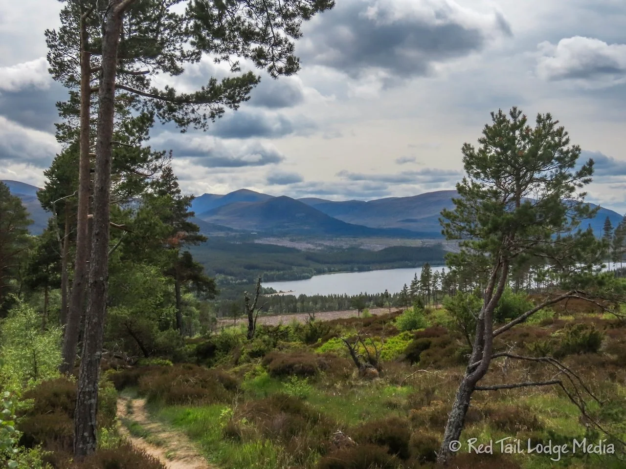
Cairngorms National Park covers a large area in the northeast of Scotland. It is a combination of forested and barren mountain peaks. There are roads around the perimeter of the park, but none through the center of it. If you want to venture into the heart of the park, you need to hike or backpack.

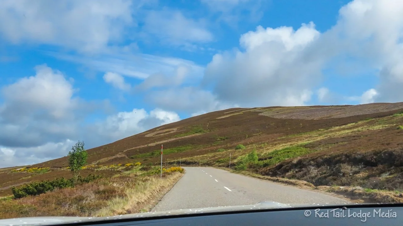
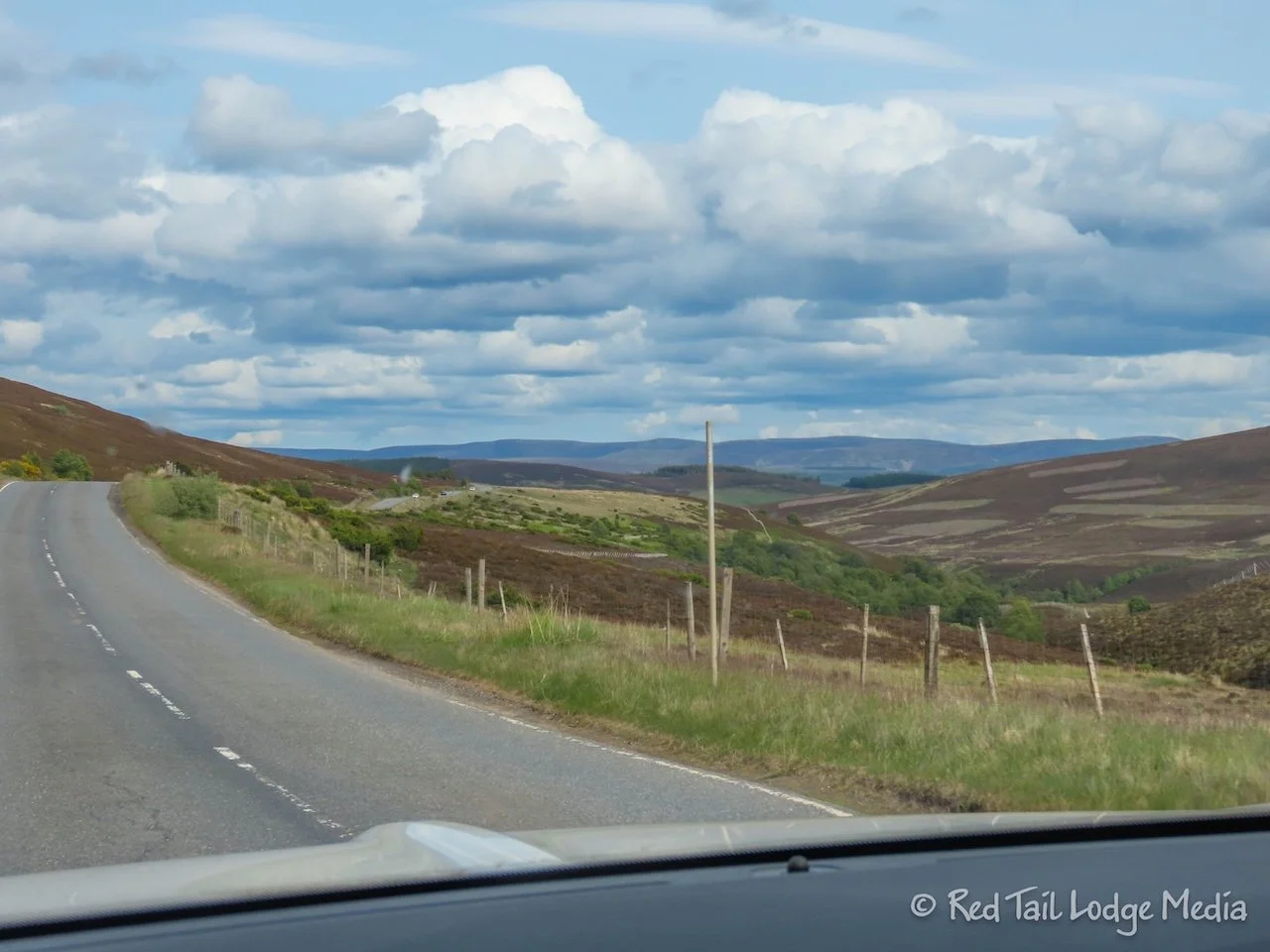
Friday was a long drive from Portree on the Isle of Skye to Ballater in Cairngorms National Park, both in Scotland. We were on “A” roads the whole way, but there were long sections of single tracks. We were hoping we would leave most of the single track roads once we left the Isle of Skye, but that was not the case. However, we were on a dual carriageway for a while, which we haven’t seen in a couple of weeks.
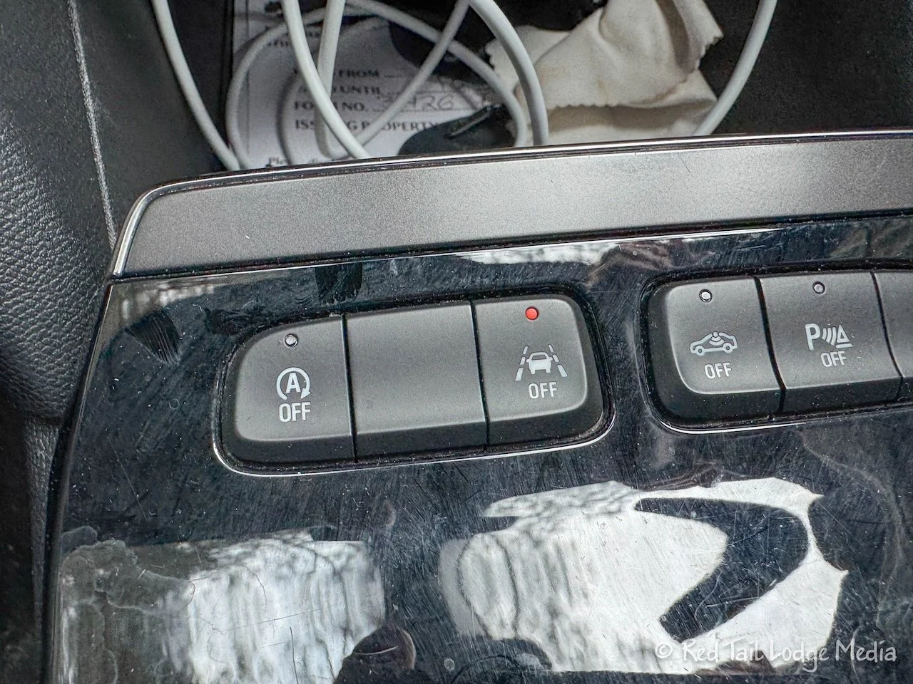
Keith was getting rather annoyed with the car’s lane assist. It kept trying to forcefully pull the car to the right, into the oncoming traffic, especially when we were on small roads with no lines painted on the edge of the pavement. Not only was it irritating, it seemed rather dangerous. We had tried to disable it before, but couldn’t figure it out. Then Keith had enough and pulled over to the side of the road and we sat there until we figured it out. We were pushing the right button before, but it didn’t seem to do anything. Then we noticed that when we pushed it, a message showed up on the dashboard saying to push and hold to disable it. So we held it for what seemed like a long time before the light on the button and an indicator on the dashboard lit up. It seemed rather odd that the light and indicator being on meant it was disabled rather than enabled. But it seemed to do the trick. However, it reset every time the engine was turned off. So we had to remember to first push the button, release it, then push and hold until the light and indicator turn on (pushing and holding without the first push didn’t work). What a pain, but at least Keith now had an easier time driving.

The drive was pretty. After crossing the Skye Bridge at Kyleakin to get off the island, we started seeing more forests. There are not a lot of trees in Scotland or all of the British Isles for that matter, so it was nice to see some mountain sides covered with trees. However, there were still tree-barren areas.
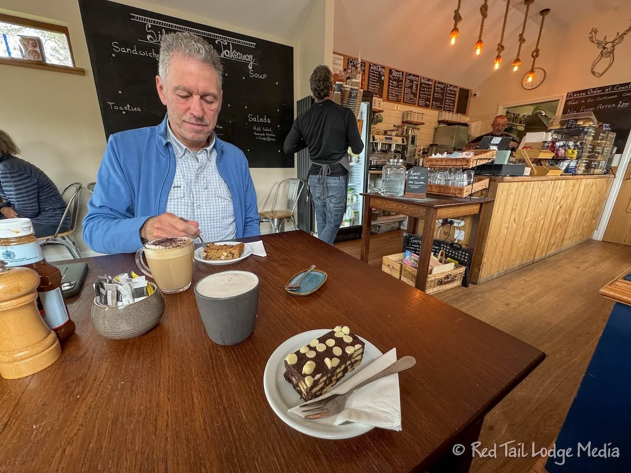
We made two stops to break up the drive and for needed potty breaks. The first stop was at the Midge Bite Cafe in Achnasheen. For some reason, they were not serving food that day but they did have drinks and bakes (pastries). Keith had a cappuccino along with a Midge Bite flapjack. Ann had a chai latte with her dark chocolate tiffin. A tiffin is a non-baked dessert with crushed biscuits (cookies) covered with melted chocolate, then cooled. This one had white chocolate chips on top. It really satisfied Ann’s chocolate cravings without being overly rich or sweet. Delicious.

Our second stop was at Scrumpy’s Coffee Shop in Grantown-on-Spey. We just had drinks this time. You guessed it, a cappuccino and a chai latte. The town was cute, with lots of stone buildings. After our drinks, we walked up and down High Street to stretch our legs and admire the architecture.

Along the way, we spotted some Highland Cattle (heilan coo), the hairy rustic cows of the Scottish Highlands. Ann made Keith stop, turnaround and go back so she could get some pictures of the coos. We also saw some pheasants, but Ann didn’t make Keith stop for those. She already has some nice pictures of pheasants this season (Broadway, England - April 10th to 11th, 2025).

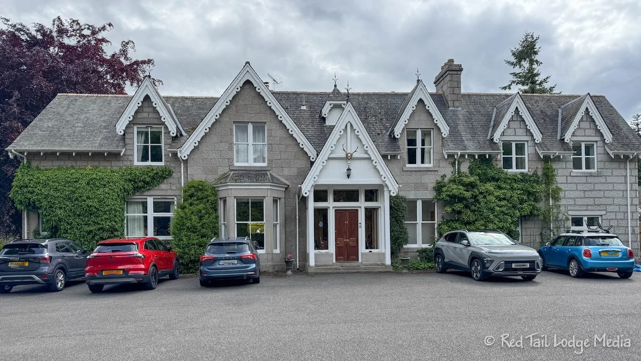
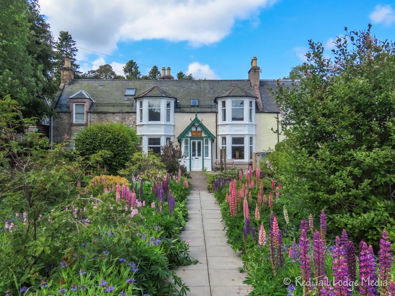
We arrived at No. 45, our lodging in Ballater, precisely at 4 pm. It is a lovely place with a lot of character. There are two lounge areas, full of wonderful furnishings and decorations. The breakfast area is in a conservatory (sun room) on the backside of the building. Our room is spacious with comfortable furnishings as well.

After relaxing for a short while in our room, we strolled into town to find a place for dinner. Ballater was even cuter than Grantown-on-Spey. We made a loop around the downtown area to check out all the places to eat. Then we tried finding a table at the Balmoral Bar, but there were no empty tables around 5:30 pm. So we headed back to the other end of the street to the Alexandra Hotel. They had one table for two, as long as we finished by 7 pm, because they were full with reservations. It was only 5:45 pm by this time, so we agreed.
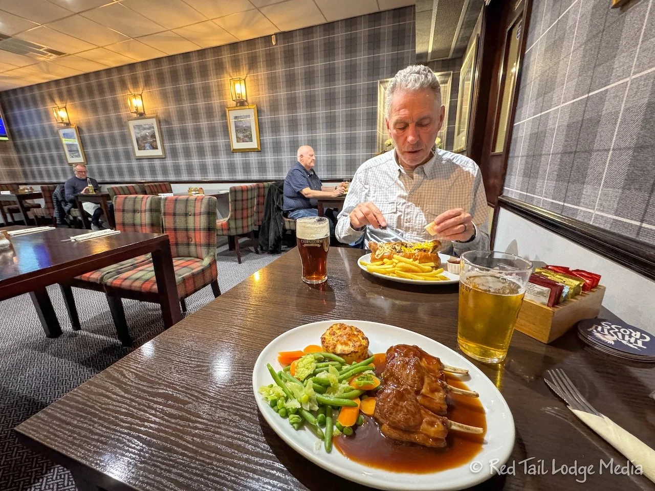
Keith was doing some foreshadowing by ordering the bratwurst with fried onions and fries. Ann had the lamb cutlets with mixed vegetables and potato gratin in a red wine sauce. To drink, Ann had a Thistly Cross cider from West Barns, Scotland while Keith drank a dark ale from Cairngorm Brewery in Aviemore. Everything was pretty tasty.

We spent most of Saturday at Balmoral Castle. The weather forecast showed rain in the afternoon, so we went early. However, the rain was mostly light, so we stayed at the castle through the afternoon.
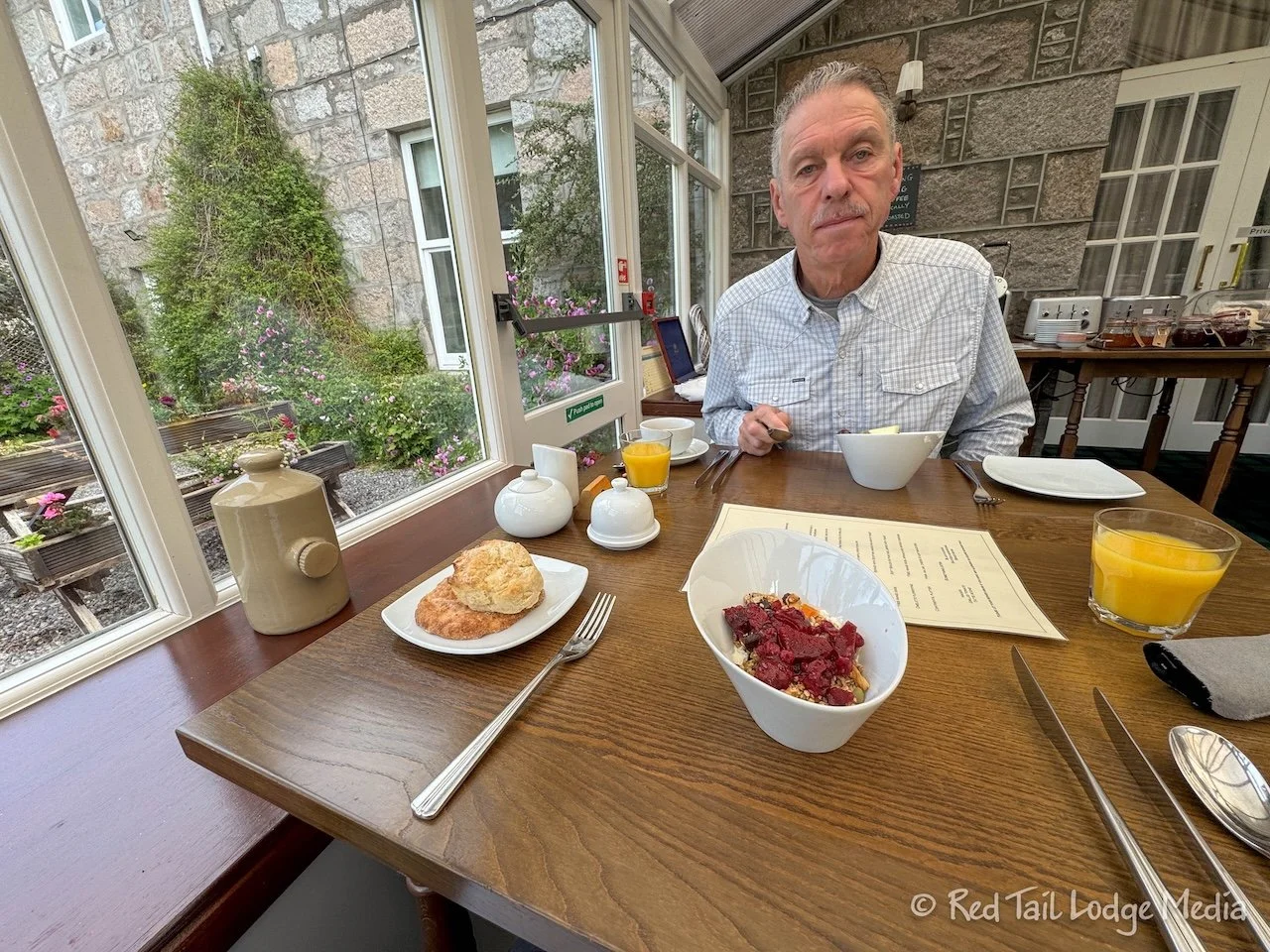
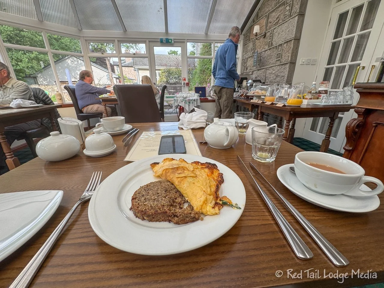
Breakfast at No. 45 B&B was wonderful. The cold buffet was full of homemade items like scones, fruit compote, and granola. There was also an item called Aberdeenshire Butteries. Butteries or rowie are savory bread rolls originating from Aberdeen, Scotland. They are flaky and buttery, but flatter and saltier than a croissant. Pretty tasty!

There were also a variety of hot food breakfast items made to order. Ann had the omelette Florentine with spinach and white cheddar cheese. The omelette was large, perhaps made with three eggs. It was delicious and filling.
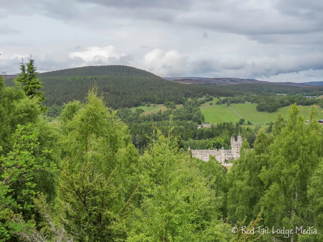
Balmoral Castle is the Highland residence of the British royal family. It is a working estate with grouse moors, forestry, and farmland covering 21,725 hectares (53,684 acres).
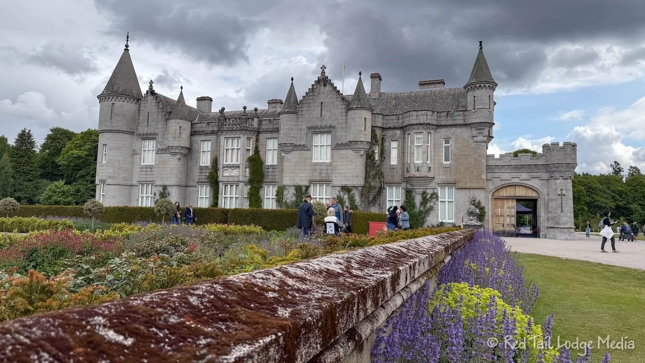
Balmoral Castle was only a ten minute drive from our B&B in Ballater. It was 5 GBP to park and then another 18.50 GBP per adult for general admission to the estate. There are guided tours of the interior during May, June, and July, but they are expensive at 110 GBP per adult. We opted for the general admission, which includes only the exhibition in the Ballroom inside the castle.

From the entrance, it is a nice walk through the woods to reach the castle and gardens. We started by exploring the gardens which included the Queen Mary Garden & Fountain, the Conservatory, the Thistle Maze, the Sunken Garden, and the Ballroom lawn maze. Then we visited the Ballroom. After taking the trail down to the River Dee, we headed over to the cafe for lunch.
There is a Balmoral Castle phone app that you can download which provides an audio tour for the grounds. We recommend downloading it before you arrive, as the cell service on the estate is not very good. We were half way through exploring the gardens before it finished downloading.
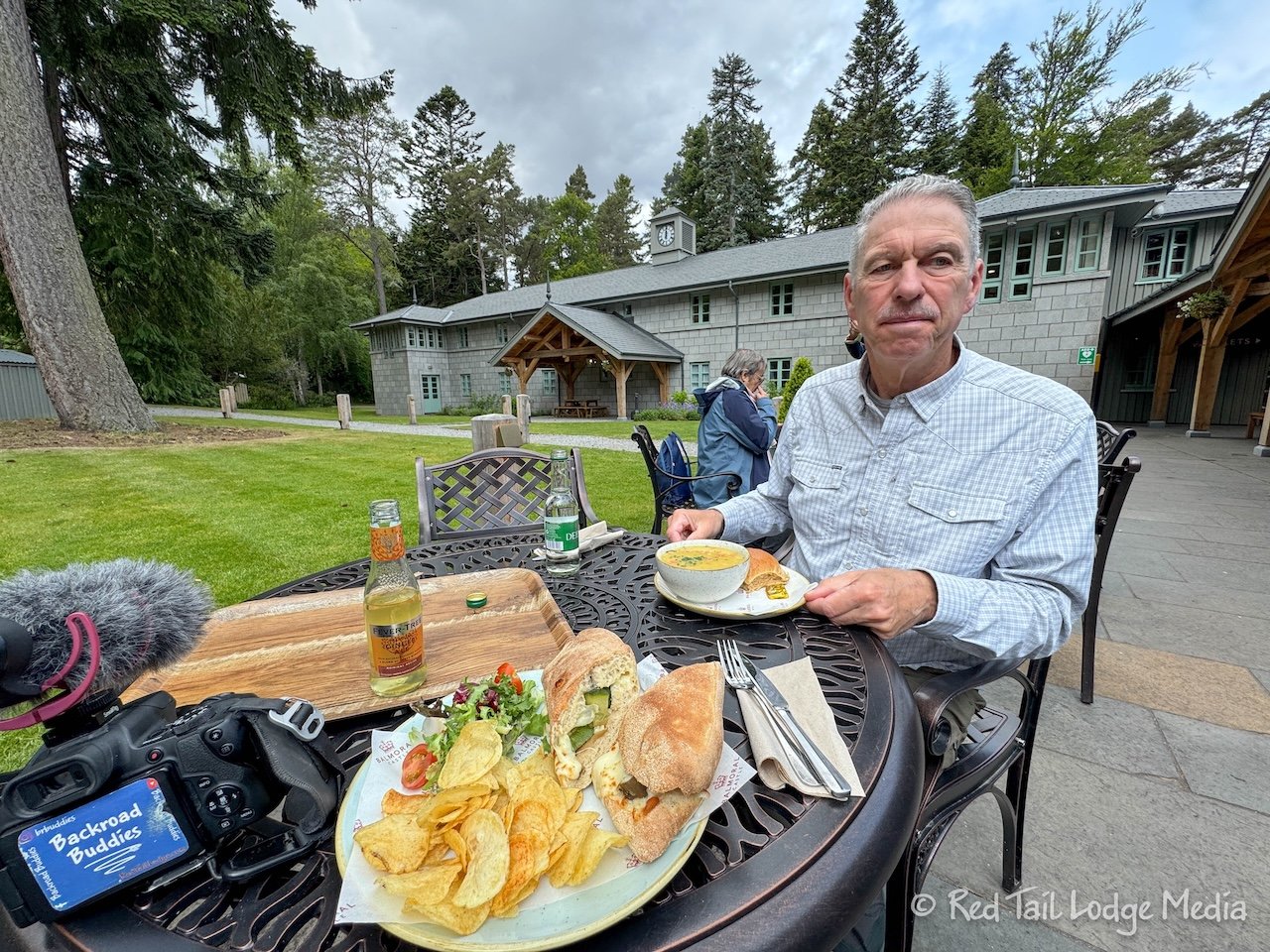
For lunch, Ann had the mozzarella and roasted veggie ciabatta, while Keith had the lentil soup. The food was pretty tasty. As we finished up, it started to lightly rain.
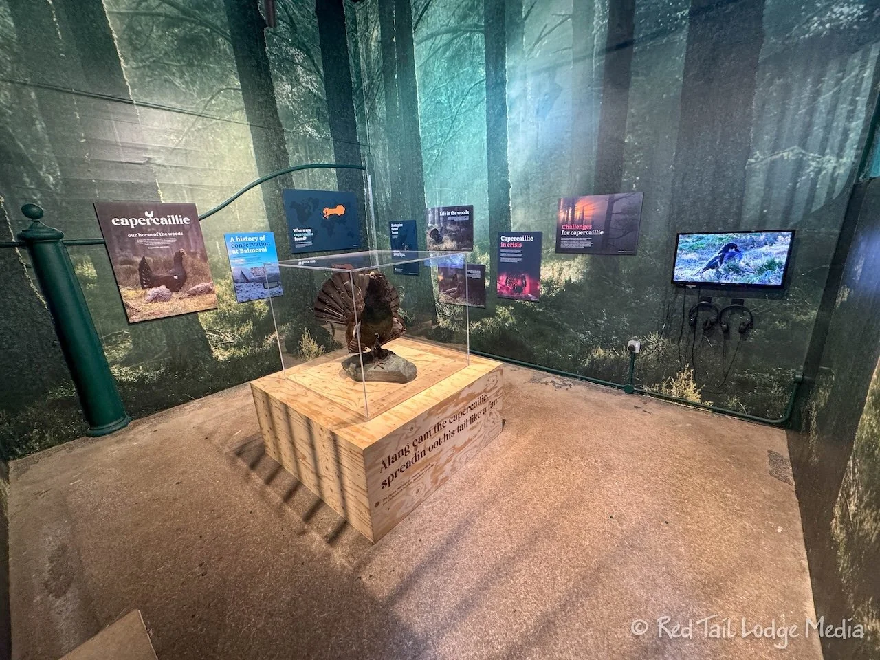
We walked behind the gift shop, over to the Capercaillie display to see what that was about. The Capercaillie is a large grouse. In the United Kingdom, they are only found in parts of Scotland, but they also inhabit northern parts of Europe and Asia. The Scottish population had become extinct, but was repopulated from the Swedish population. They reside in mature conifer forests. About 80% of the UK’s capercaillie population resides in the Cairngorms National Park, including the Balmoral Castle estate.

Donning our rain jackets and umbrellas, we decided to go for a walk in the woods. There are several well marked trails through the estate. The one we followed was the Blue Route, since it looked like it had the most cairns along it. There are 16 stone cairns on the estate. They commemorate members of the British royal family and events in their lives.

On the first half the Blue Route, we didn’t see any cairns, just a statue of John Brown (Queen Victoria’s favorite servant), so we thought we might be missing them, since we weren’t really sure what they looked like. We chatted with a couple of other hikers who showed us that the cairns locations are marked in AllTrails, so we started referencing that.
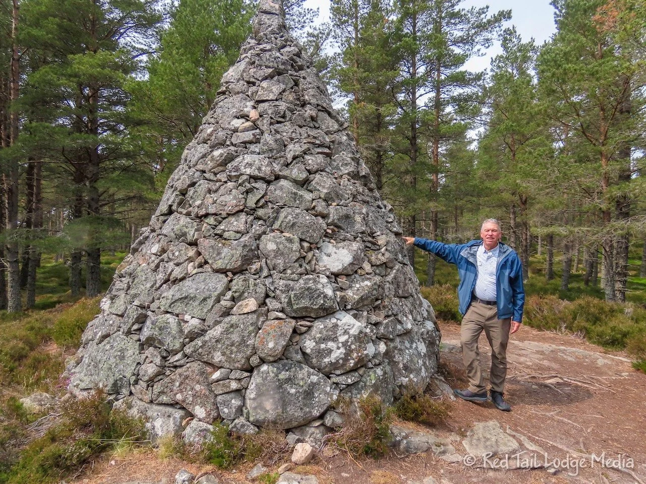
The first one we came across was up a short spur trail off the main trail. If we hadn’t been looking at AllTrails, we would have missed it. Most of the rest of the ones we visited could be seen from the trail, but better views were obtained by short spur trails to most of them. We even went down a short section of the Red Route to pick up another cairn.
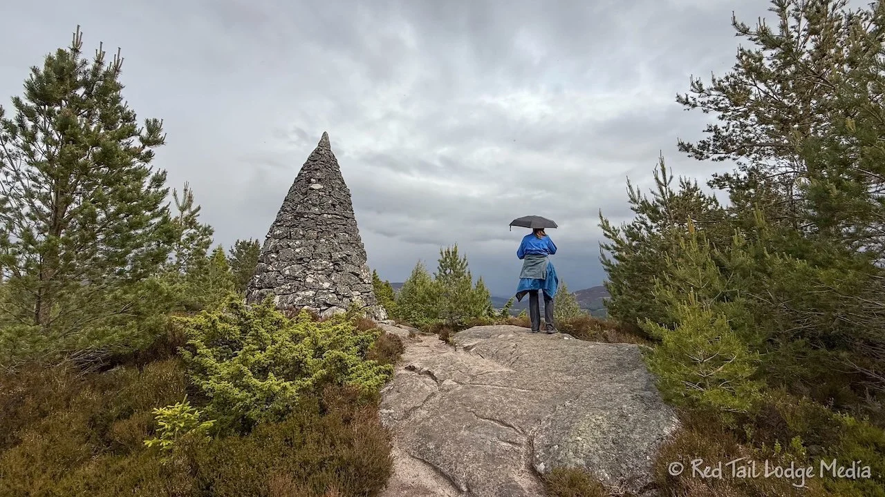
The cairns we saw were Princess Helena’s, Princess Louisa’s, Purchase Cairn, Prince Arthur’s, and Prince Leopold’s. The Purchase Cairn had wonderful views of the surrounding landscape. From Prince Leopold’s cairn, you can view the castle from above.
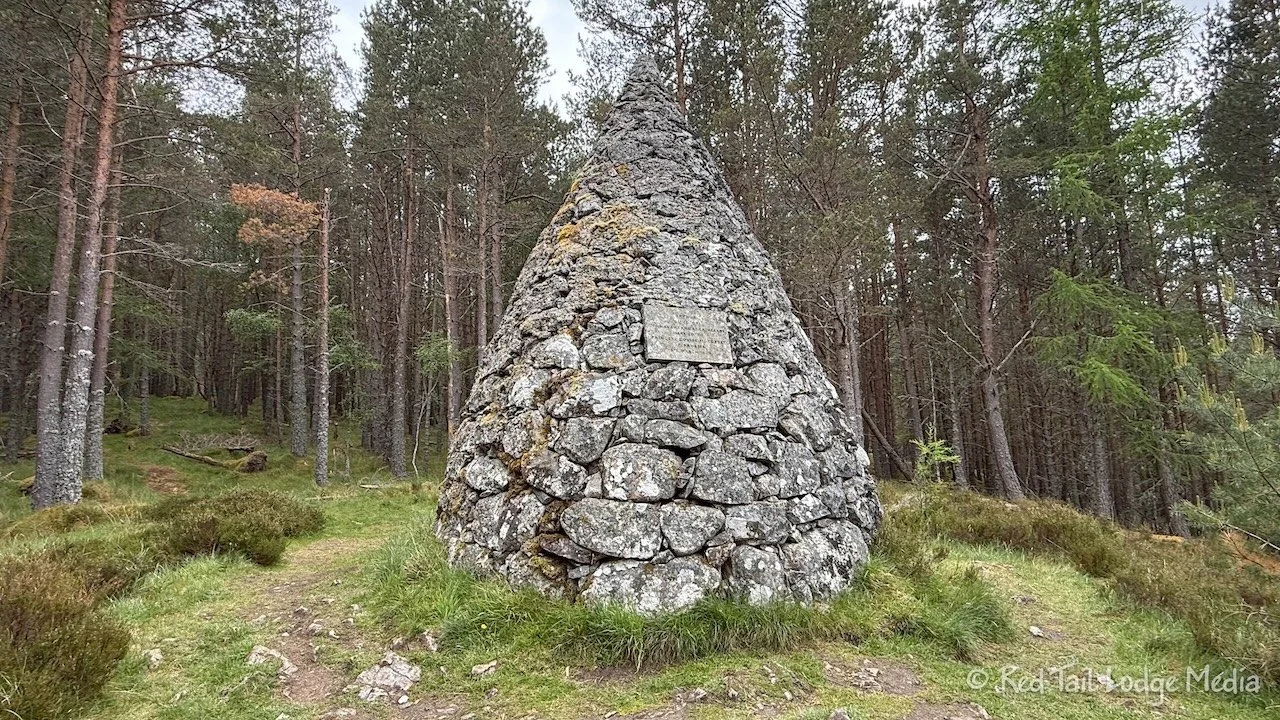
All the cairns we saw were cone shaped. However, Prince Albert’s Cairn is a pyramid. We didn’t realize that Prince Albert’s was not that far from the Blue Route. If we had known, we might have extended our walk to see it. Although each of the cairns were not that exciting to see, they made for a nice scavenger hunt to find them. We spent about an hour and a half walking through the woods, covering a few miles.

After returning to the B&B, we walked into town for ice cream, at Shorty’s Ice Cream Parlor. Keith had a milkshake with the Ballater Cream flavor of ice cream. Ann had a cone with chocolate and mint chocolate. Some habits are hard to break.
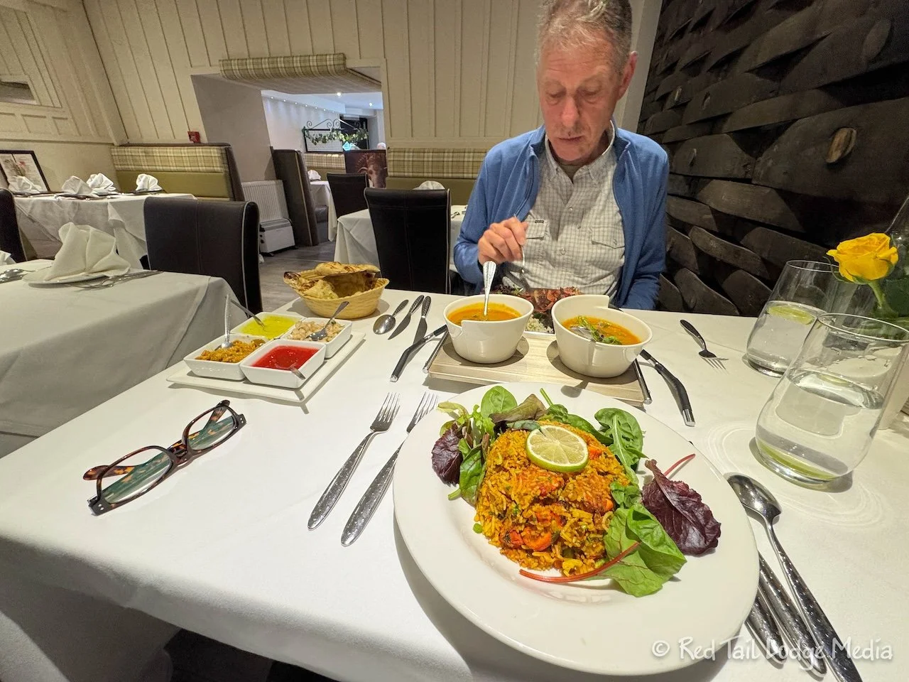
For dinner, we tried to get a table at Balmoral Bar. We went right around 5 pm, but no luck. So we headed over to Lochnager Indian Brasserie. Ann ordered the chicken tikka biriyani, while Keith had the tandoori chicken. Biriyani is a mixed rice dish and it was served with a vegetable curry. Tikka refers to the way the chicken was prepared, being marinated, grilled, then cooked in a tandoor oven. So both of our chicken dishes were roasted in a tandoor, a cylindrical clay oven. All of the food was delicious.
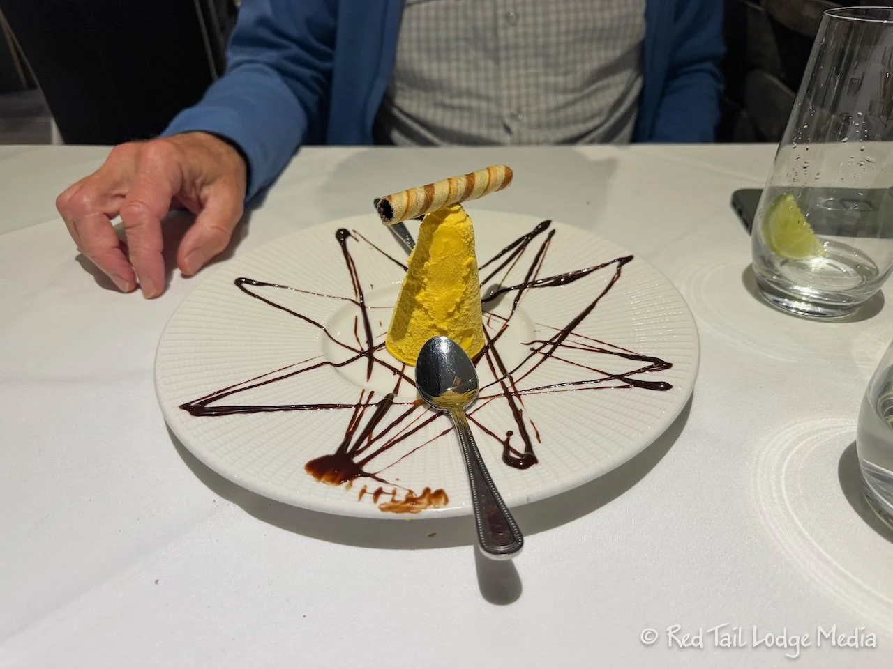
Ann was so full that she couldn’t finish her food, which is unusual for her since she still has that “clean your plate” mentality that she was raised with. Keith ordered the mango kulfi just to see what it was like. Kulfi is India’s version of ice cream. It is denser and creamier than regular ice cream. Keith let Ann have one bite of his dessert so she could taste it. It was wonderful.
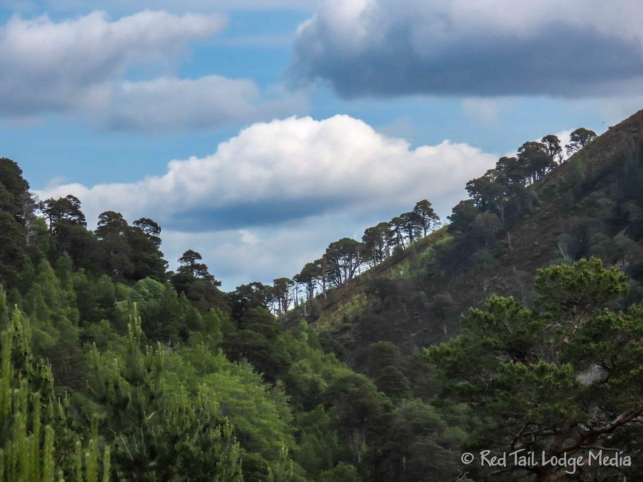
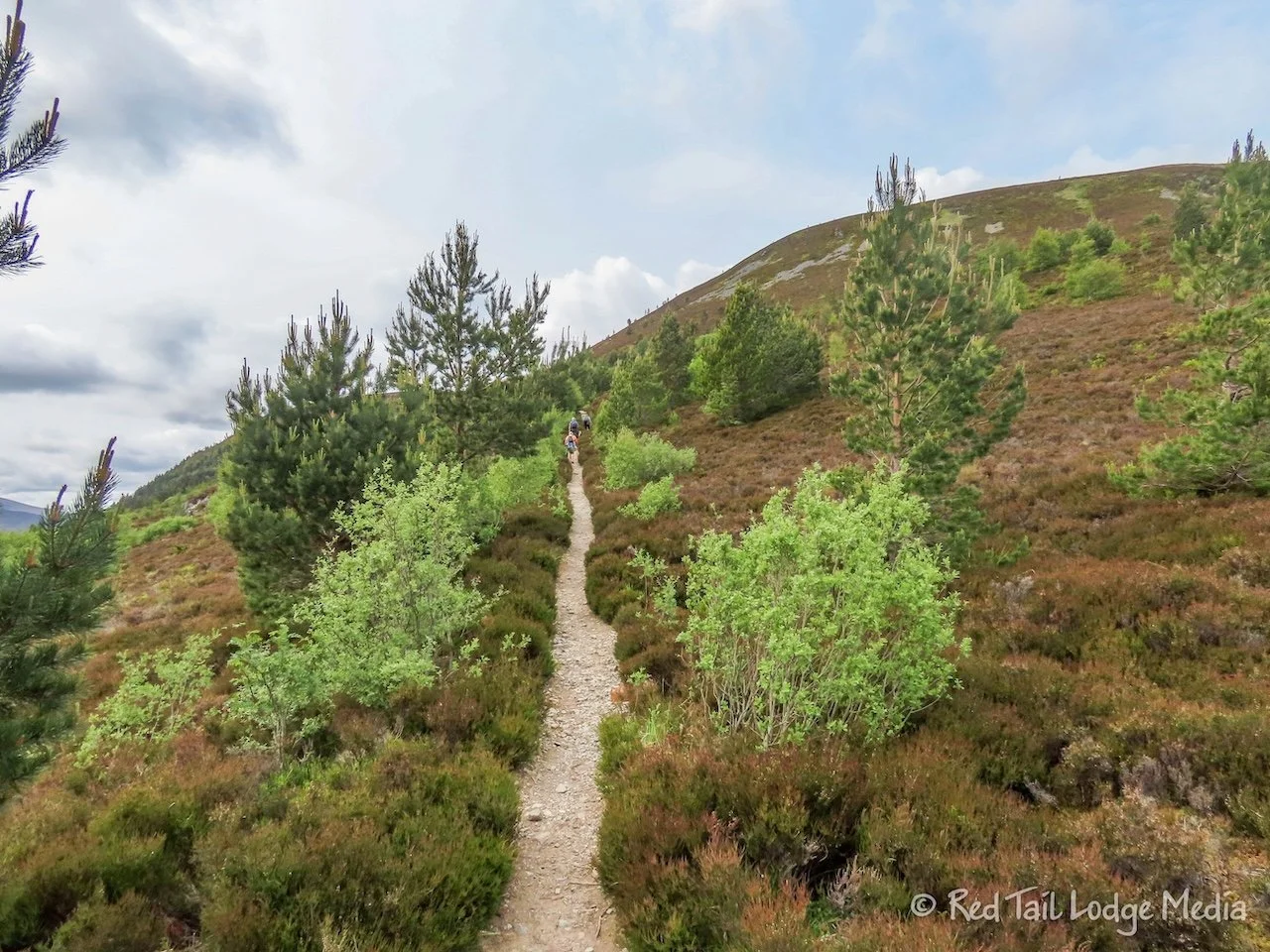
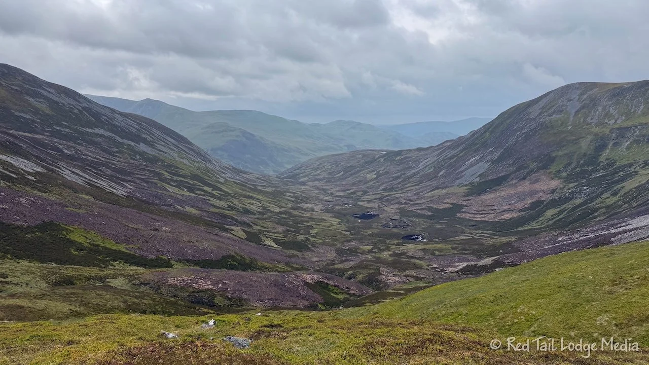
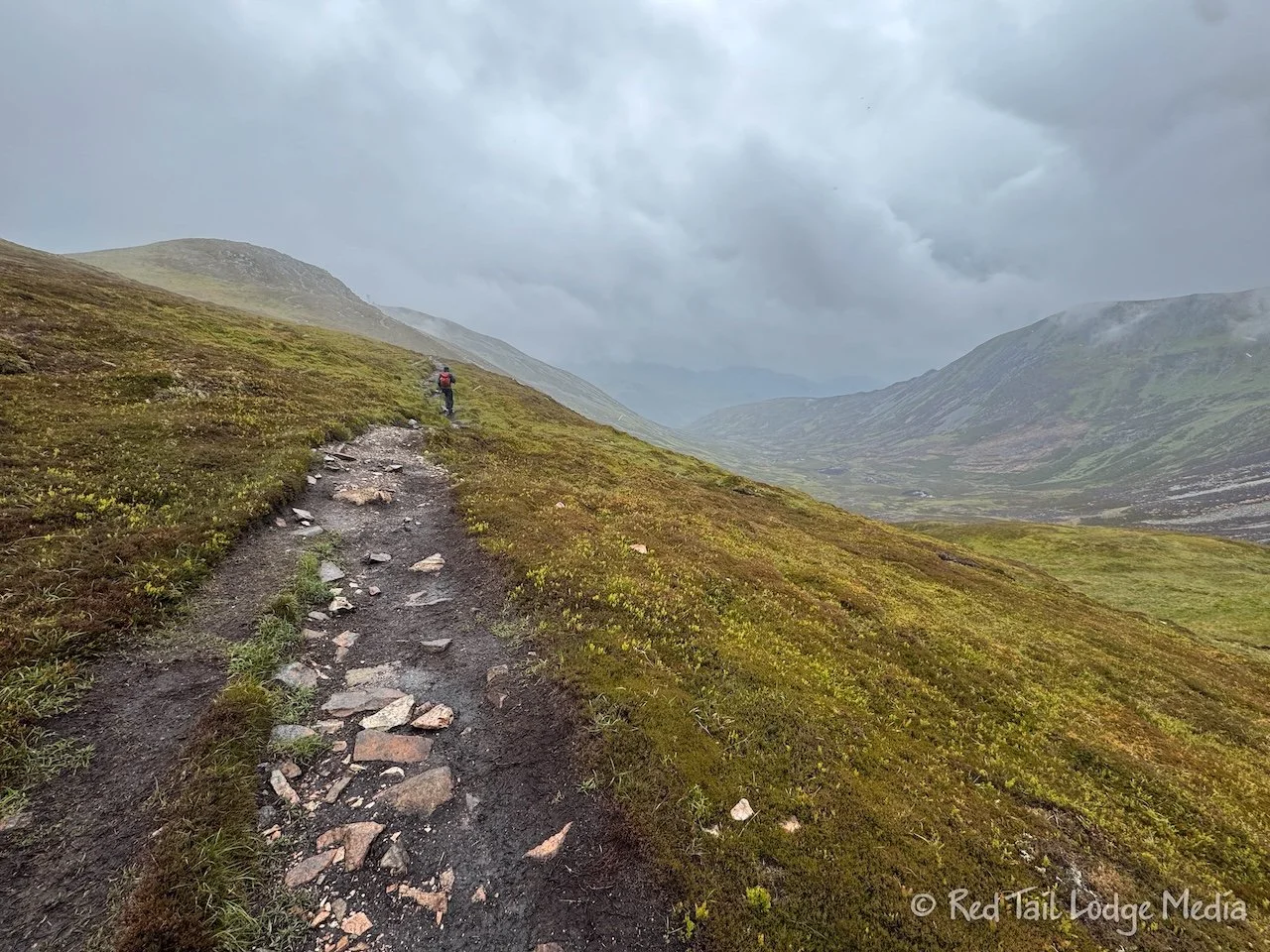
Sunday, we drove over to Glenmore Forest Park, on the other side of Cairngorms National Park to go on a hike. The route in AllTrails was called Meall a’ Bhuachaille. Glenmore was about an hour and a half drive from Ballater, but the trails at Glenmore were highly rated in AllTrails and we needed to up our game for training for the Tour du Mont Blanc later in the season. This trail was only 5.4 miles long, but it had an elevation gain of 1984 feet, which we needed.
Keith wasn’t too happy about driving that much on a non-travel day, but he obliged. At least the route was scenic, mostly on the road that we came into Ballater on just two days prior, route A838, the Old Military Road. We saw the Highland Coos again along with pheasants, but we didn’t stop for them this time. We also caught a glimpse of a red squirrel, but didn’t get a picture. We’ve seen lots of signs in Scotland, England, and Ireland to slow down for the red squirrels. Their populations have been decreasing in these regions, so there is an effort to try to conserve them. This was our first sighting of a red squirrel. We were beginning to think they didn’t exist.
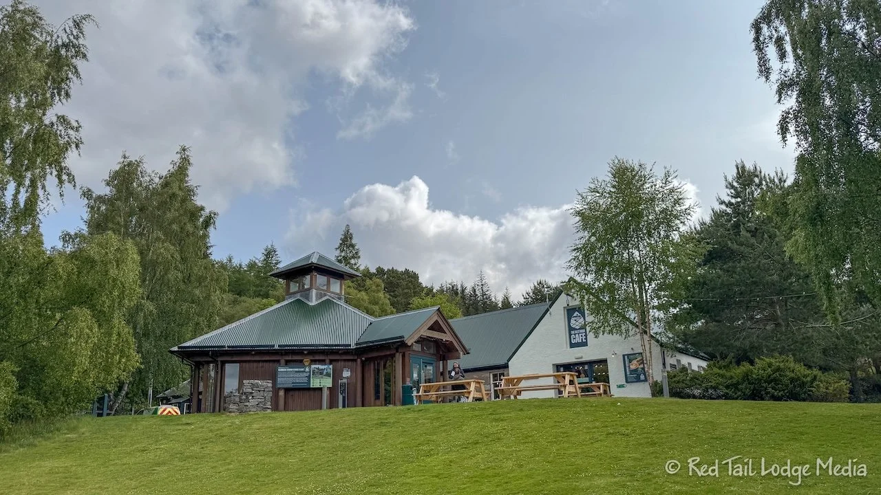
It was 8 GBP to park all day at the Glenmore Forest Park visitor center car park. There is a cafe and toilet facilities there. We checked what time the cafe closed to see if we could stop for food after our hike. They closed at 4 pm with only takeaway after 3:30 pm. Perfect! It was about 10:30 am when we arrived and about 10:50 am by the time we started hiking.

The route starts out by going past the Cairngorm Reindeer Centre. The Cairngorm Reindeer herd is the only free-ranging herd in the United Kingdom. In addition to guided two hour hill trips to see the reindeer (23 GBP per person), they also have some reindeer on display at the center’s paddock. It costs around 3 pounds per person to visit the reindeer in the paddock. We did not stop to see the reindeer.

The route then goes through the forest, among some beautiful old trees, before reaching An Lochan Uaine. An Lochan Uaine translated to green tarn (small mountain lake). According to legend, the green color of the lake is caused by fairies washing their clothes in the loch.

After passing the loch, just before the start of our steep ascent, there is a building. We were curious as to what it was, so we walked around it to the door. There were people inside, including a nice gentleman who we chatted with for a little while. The building is called Ryvoan Bothy. A bothy in Scotland is a basic shelter, usually unlocked and available for anyone to use free of charge. They usually have no electricity, no piped fuel supply, nor piped water supply. This particular one had a fireplace and a few tables and chairs.

A Scottish charity called the Mountain Bothies Association (MBA) helps look after 104 bothies in Scotland, even though they only own two of those. They rely on volunteers and donations to survive. The man we were speaking with was wearing an MBA t-shirt. Hikers, backpackers, and mountain bikers can use the bothy for shelter, to warm up, dry out, or enjoy a meal out of the wind.
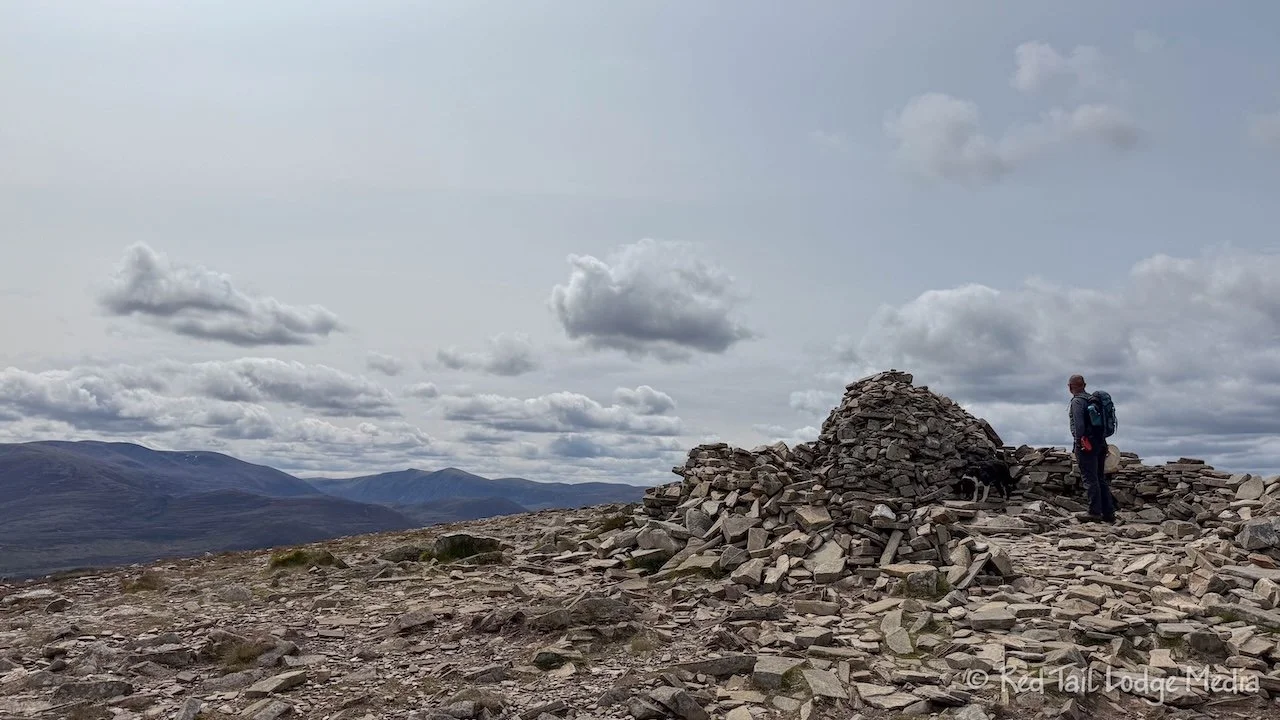
The climb up to the peak of Meall a’ Bhuachaille was steep, but the footing was pretty good. In the steepest sections, which was the majority of the climb, there were nicely maintained stone stairs. At the top, there was a stone cairn along with a circular stone wall for a wind break. Everyone seemed to be taking advantage of the wind break and sat down for a meal or snack inside the circle. We were in the minority, as we didn’t have a dog with us.
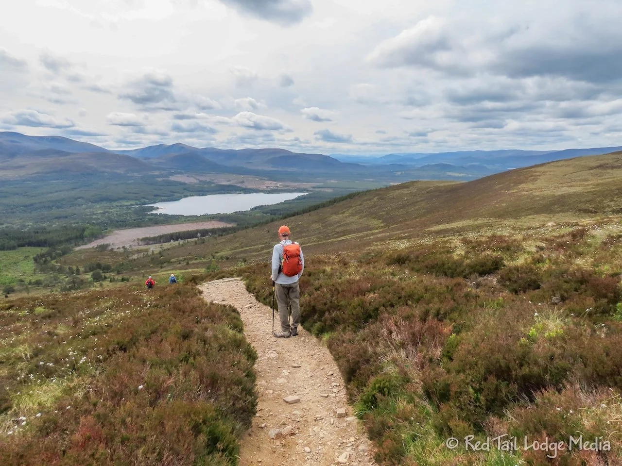
From there it was a long decent back down to the visitor center. Before reaching the bottom, the trail re-entered the woods and followed alongside a stream. All in all, it was a nice trail with a lot of variety.
By the time we returned to the visitor center, we had gone 9.4 kilometers (5.8 miles) with an elevation gain of 627 meters (2057 feet) in just under three hours. It was hike number 25 of our 52 Hike Challenge for 2025.

It was just after 2:30 pm, so the cafe was still open. However, they were out of soup. Ann earlier saw that the soup of the day was cream of broccoli soup, one of her favorites. She was looking forward to having some after the hike, but it was not meant to be. Instead, we had some cold sandwiches. Ann had egg salad while Keith had ham and cheese. A couple of bags of crisps (potato chips), cans of soda, and a couple small containers of Loch Ness ice cream rounded out our meal. Ann had chocolate mint ice cream while Keith had vanilla. The ice cream wasn’t too bad. The mint ice cream was a little different, as the thin flakes of chocolate were not mixed into the ice cream, but sitting on the top and bottom.
Then it was an hour and a half drive back to Ballater. Since we had a late meal at the cafe in addition to the snacks we had on our hike, we decided to skip dinner and just relax back in our room.
Monday, we went on another long and steep hike. The start of the route, called “Carn Aosda, Carn a'Gheoidh, The Cairnwell” in AllTrails, was just a 30 minute drive from Ballater, at the Glenshee Ski Centre.

The No. 45 B&B offered packed picnic lunches, so we arranged to have one prepared for us on Monday morning to take along on our hike. The lunch included a ham & cheese sandwich, a bag of crisps (potato chips), a banana, a slice of spiced cake, a Fox’s Rocky bar (a chocolate biscuit bar), and a bottle of water for 12 GBP per person.

Our hike included summiting three different Munros. A Munro is a mountain peak in Scotland that is over 3000 feet in elevation. They were named after Sir Hugh Munro, 4th Baronet, who, in 1891 produced the first list of those peaks, known as the Munro’s Tables. There are 282 Munros in Scotland, of which we only “bagged” three. There are several Munros in Glencoe National Nature Reserve, but we didn’t summit any of them while we were there (Glencoe, Scotland - May 30th to June 1st, 2025).

We arrived at Glenshee Ski Centre before 10 am. A helicopter was in the parking lot when we arrived. It was hauling loads up to the top of the Cairnwell. It looked like they were building another tower at the summit. Perhaps it was another cell tower. There were already three other towers on the mountain peak.
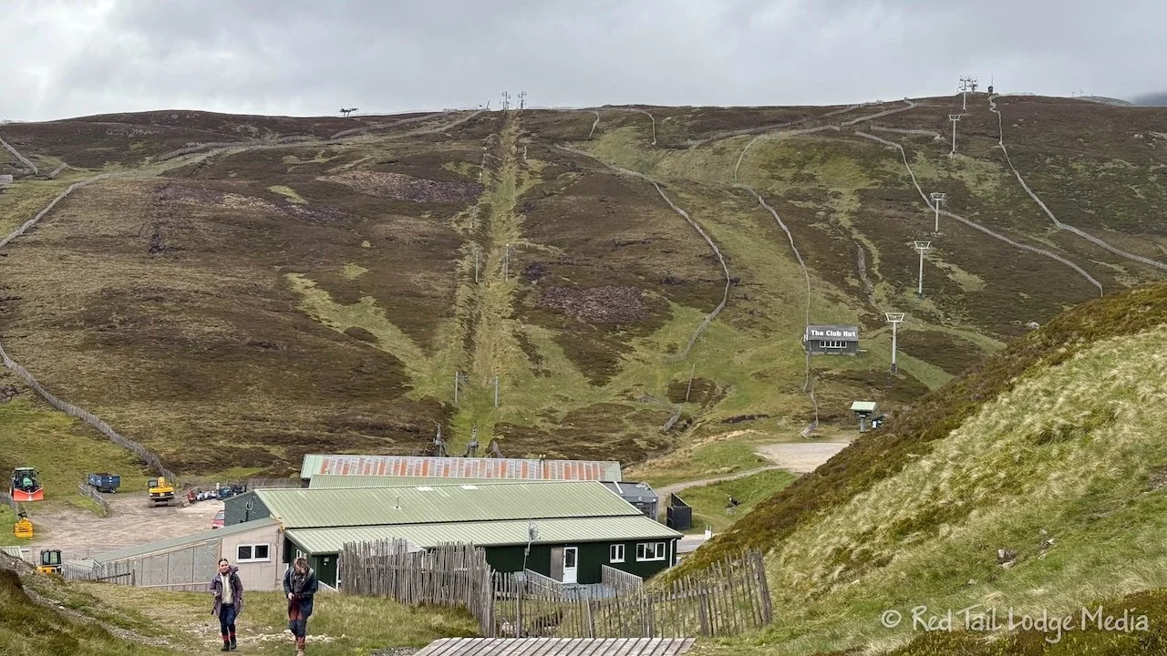
It was 4 GBP to park. There wasn’t a machine, but just a bar code to load a web page. Or you could just go inside the nearby cafe and pay there. Ann first tried filling out all the information and paying through the website. After entering all kinds of info, there wasn’t a strong enough cell signal to get the payment screen to load. What she did like, was that there was a note area where you could explain the route you were hiking and what time you expected to return. They said that search and rescue would use that information if your vehicle was left past the expiration of your parking pass. However, Ann gave up and went inside the cafe to pay. The only information the cafe took was our car registration (license plate number).
While she was inside the cafe, she noted the time the cafe closed so we could try to be back in time to get some hot food. It closed at 4:45 pm. Great! That should give us plenty of time to finish our hike.
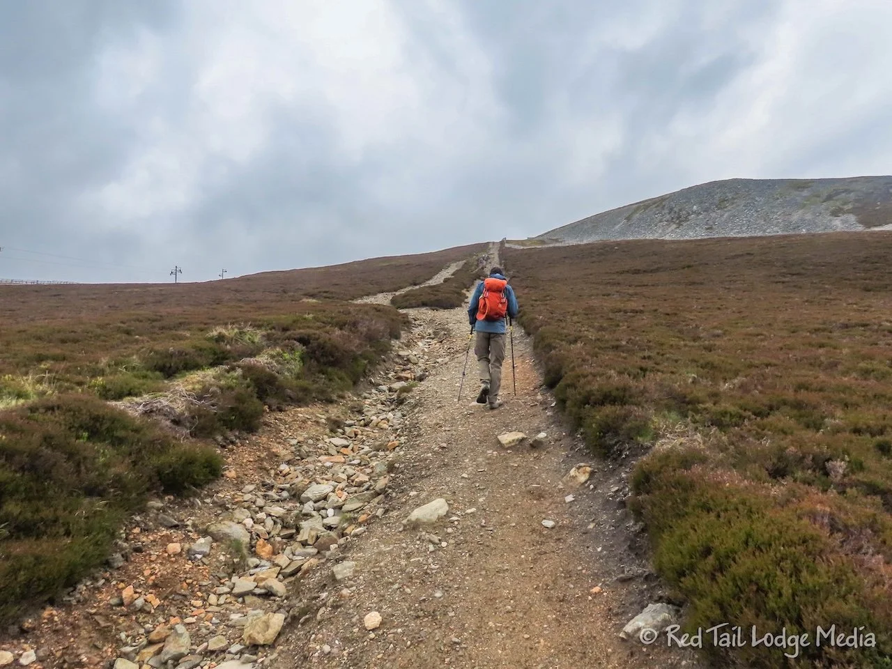
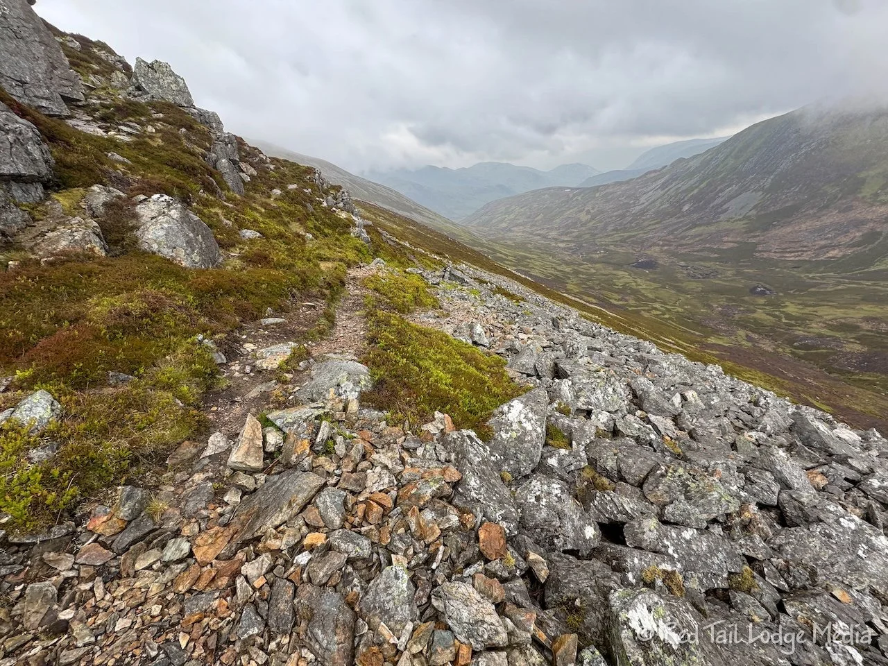
We were on trail by around 10 am. It started out cloudy and cool, with temperatures in the single digits Celsius (40’s Fahrenheit). The route started out following the ski area service roads. However, these roads are mainly used in the winter with snow on them, so they were not smooth or level footing as they were full of large rocks.
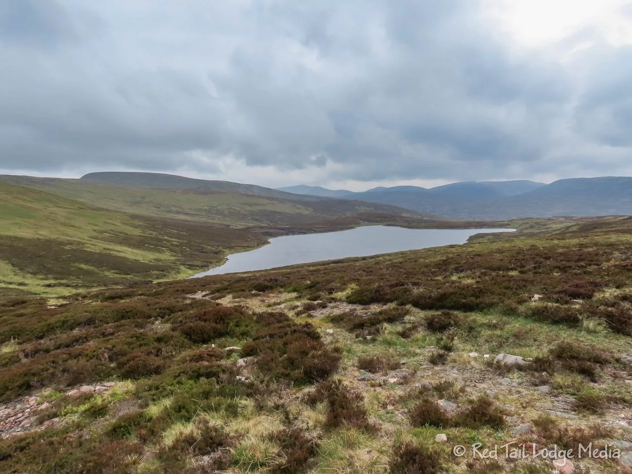
We reached the summit of the first Munro, Càrn Aosda, in an hour. It was the longest climb of the day. The rest of the route was shorter ups and downs. It took much longer to reach the second Munro, Càrn a’ Gheòidh, as it was much further away. Along the way, we passed by several mountain lakes. The largest one was called Loch Vrotachan.

As we passed Loch Vrotachan, we turned onto a proper hiking trail. It went through a boggy area where we got our feet a little wet. Then it started to rain. The rain got heavy enough that we eventually put on our rain pants.
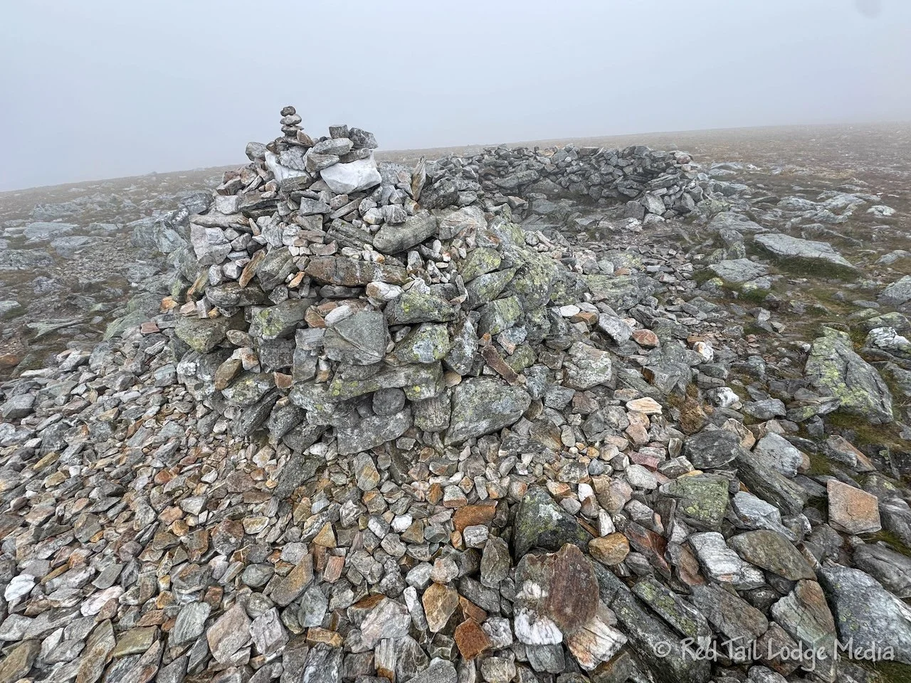
When we reached the summit of Càrn Aosda, the rain had turned to freezing rain. A low cloud had rolled in, so we had no view from the summit as we were totally socked in by the fog. This was the furthest point of our hike and about half way. We would have liked to sit down and eat our lunch at this point, but not in the freezing rain. There was a rock cairn along with a circular rock wall wind break, so it would have been a nice place to take a break had it not been for the freezing rain.

Instead, we hiked back to a rocky outcropping that provided some shelter from the wind. It was no longer freezing rain by that time, just a light rain. We sat among the boulders, being careful not to drop anything. If something were to fall down the cracks between the boulders, we would have never retrieved it. We managed to eat our lunch and not lose anything.
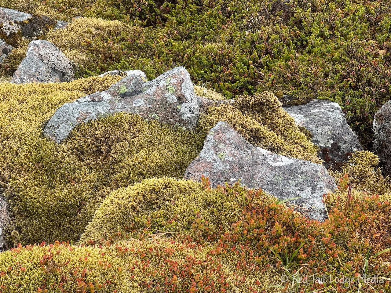
The alpine tundra of the area looked familiar to us. The spongy, mossy terrain with low growing plants and flowers reminded us of our time in Denali National Park in Alaska (Denali National Park: Teklanika River, Alaska - August 4th to 8th, 2022). It seemed a little strange to see alpine tundra at 3000 feet of elevation, but tundra exists at lower and lower elevations the further north you go. We were currently further north than Ketchikan Alaska, almost as far north as Juneau Alaska.
From there, we headed over to the Cairnwell, our last Munro for the day. This was the summit with the towers on top. The work on the tower had stopped, probably due to the helicopter not being able to fly in the bad weather. Our views came and went for the rest of our hike, as the clouds rolled by. Of course, when we reached the summit of the Cairnwell, we were in fog again.
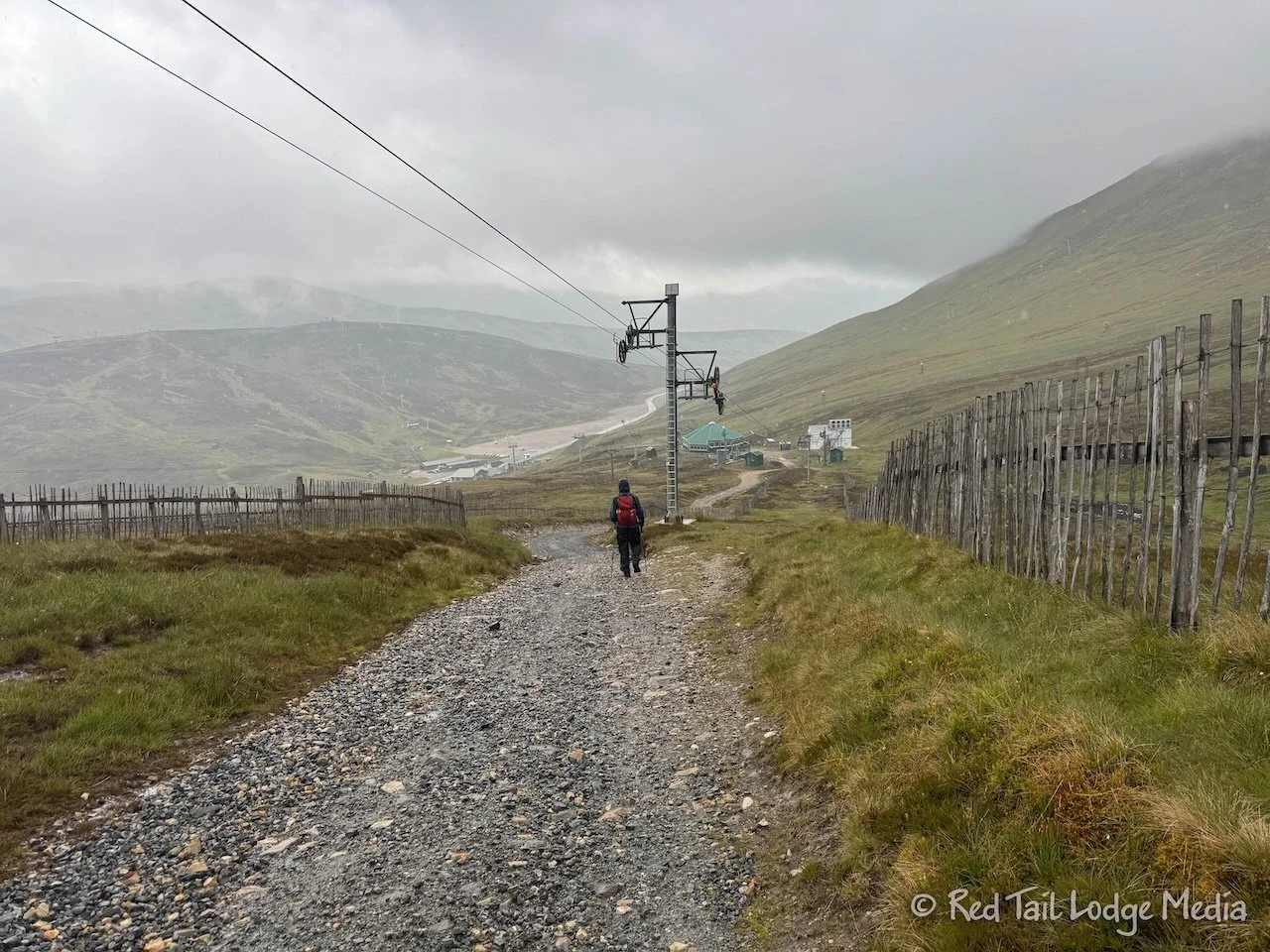
Then it was mostly down hill, back on the service roads again, so it was easier going than on the hiking trails. By the time we reached the cafe, it was almost 3:30 pm. Plenty of time to get food at the cafe…or so we thought. As Ann was eyeing what was on the menu, she learned that the kitchen closed at 3:30 pm. We had five minutes to order. Whew! So glad we made it back in time.
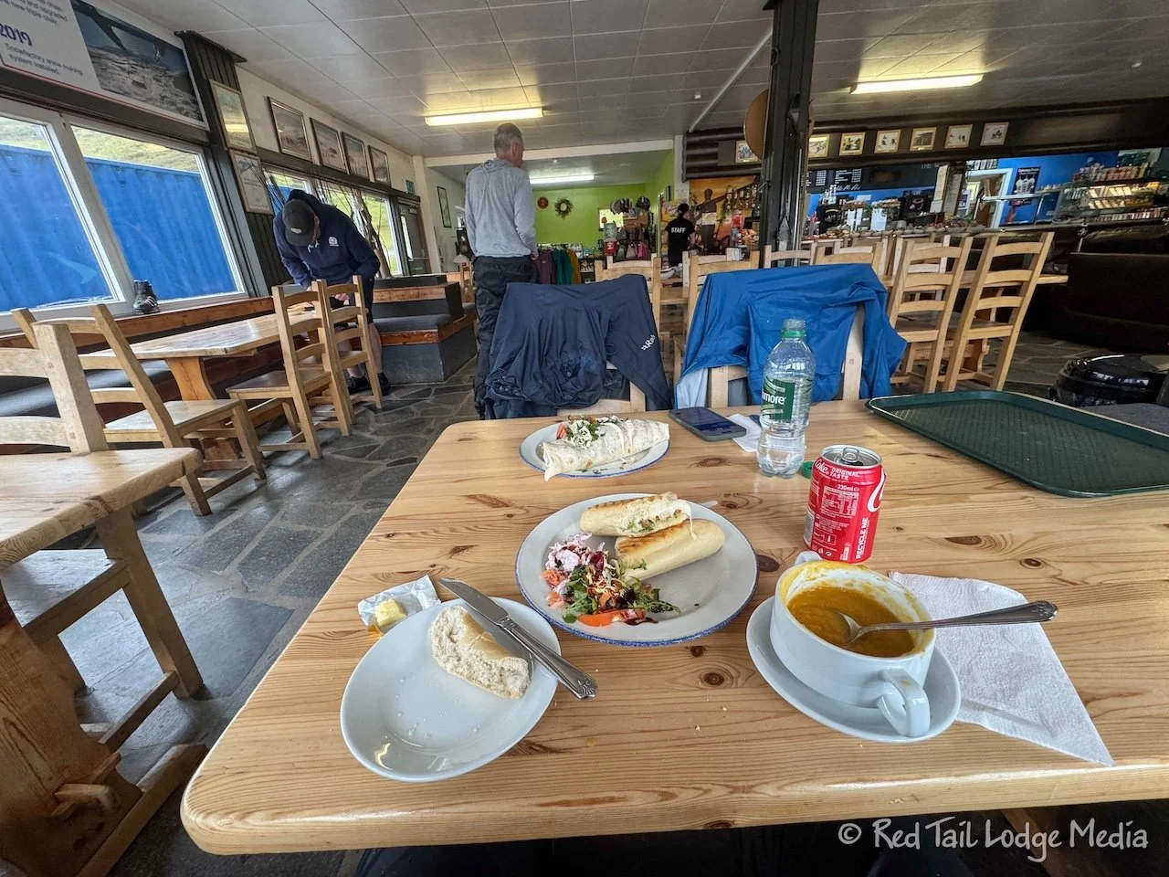
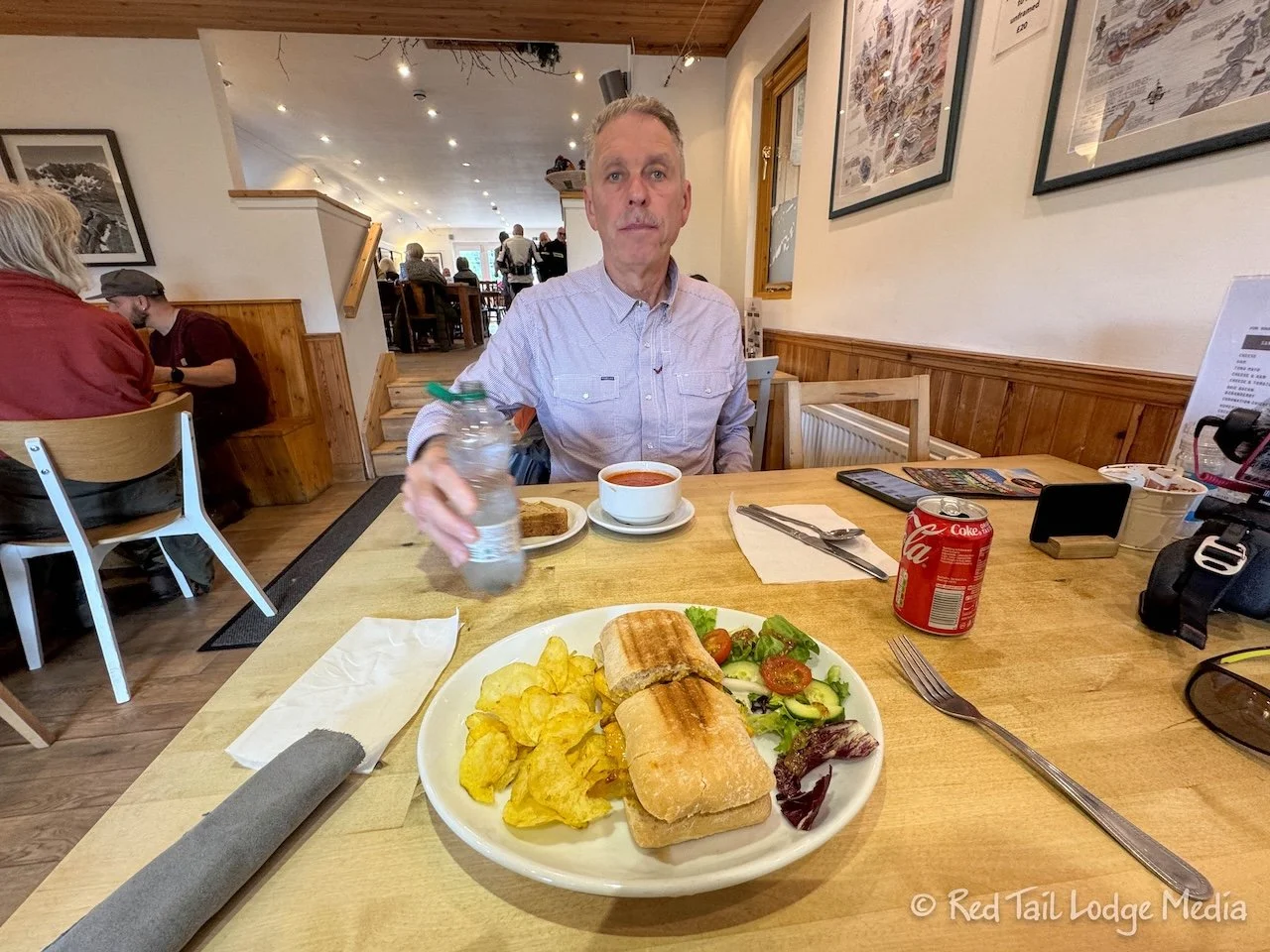
Ann ordered the soup along with a pesto, mozzarella, and tomato panini. The soup wasn’t cream of broccoli, but it was butternut squash. Ann was just glad they still had some. Keith had the pulled pork wrap. Both of our sandwiches came with a small salad. The food was pretty good. Since it was so late in the day and we already ate a lunch, we counted it as our dinner.
In total, our hike for the day was 13.4 kilometers (8.3 miles) with an elevation gain of 615 meters (2018 feet) which we completed in five hours and 13 minutes. It was hike number 26 of our 52 Hike Challenge for 2025. It was a great confidence boost for our Tour du Mont Blanc later in the season since we covered a longer distance with significant elevation gain and still felt good afterwards.

We must have been tired when we left the Glenshee Ski Centre. Keith pulled out of the parking lot and onto the road. It took several seconds for Keith to realize that he was driving on the wrong side of the road. Ann didn’t even notice. That was the first time we’ve made that mistake. Most times, Ann reminds Keith when we start out in the car. Stay left, look right first. This time she didn’t remember to say anything. Thankfully, there was no traffic on the road.
Back at the B&B, we spent most of the evening trying to dry out all of our gear. We managed to get most of it dry by the following morning, with the exception of our hiking boots. They will have to dry out the rest of the way in the car.
Tuesday was a short travel day, so we made a couple of stops along the way. At breakfast, before we left No. 45 Bed & Breakfast in Ballater, we decided to try the haggis. We knew it contained sheep’s pluck or offal (heart, liver, and lungs) and we generally are not a big fan of organ meats. So we were not expecting to like it. But it turned out to be very tasty. It is not too dissimilar to black or white pudding in the UK. The closest thing to it that we’ve had in the States is probably Thanksgiving dressing. The flavor of the organ meats is disguised with onion, oatmeal, suet (animal fat), and spices. Haggis has a rather nutty texture and nice flavor.
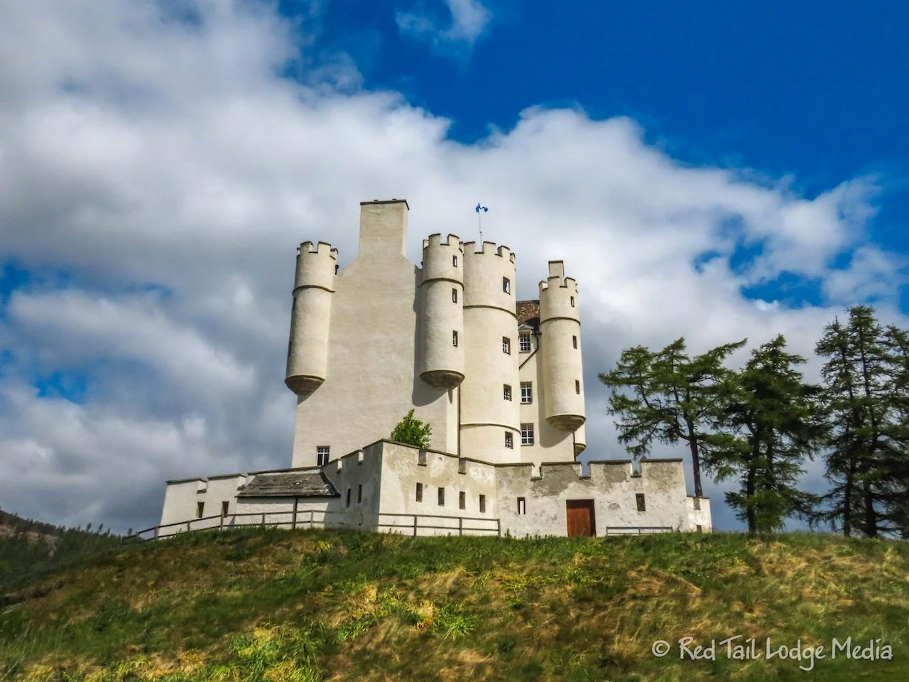
From Ballater, we drove down to Braemar. There is a cute, little castle there. Unfortunately, it is closed on Mondays and Tuesdays, so we just walked around the grounds, admiring it from the outside. There is a similar castle in the other direction on Old Military Road, called Corgarff Castle, but it is also closed on Mondays and Tuesdays.
After filling up our car with gas, we parked and strolled around the village of Braemar. It was a charming town. Then we stopped at the Bothy Braemar coffee shop for lunch.
Ann ordered the coronation chicken ciabatta while Keith had the tomato and pepper soup. Coronation chicken is an English dish which was created for the coronation of Queen Elizabeth II in 1953. The chicken is seasoned with parsley, thyme, bay leaf, cumin, turmeric, ginger, and peppercorns, then mixed with cream or mayonnaise along with dried apricots or sultanas (white grapes). It was pretty tasty.
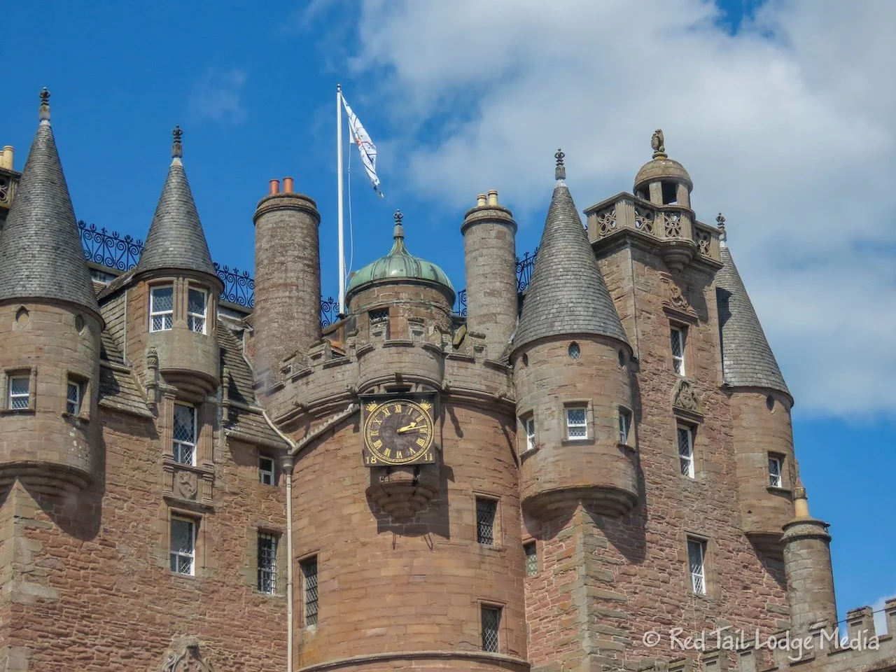
Then we continued on our way towards St. Andrews, stopping to tour the Glamis Castle along the way. But we’ll cover that in our next post along with St. Andrews.
Although hiking was our main focus while we were in Cairngorms National Park, we appreciated the variety of terrain, scenic drives, villages, and castles. So even if you don’t want to hike, there is still plenty to enjoy inside the park.
Check out our related video: Cairngorms National Park, Scotland
(Ann)