
Dartmoor National Park, England - March 28th - 31st, 2025

Dartmoor National Park was our first visit to a national park in Europe. It was very similar to our national parks in the States in that it had a nice variety of landscapes, wildlife, and history. We found it to not have the same level of infrastructure that we are accustomed back home, but we enjoyed our visit all the same.

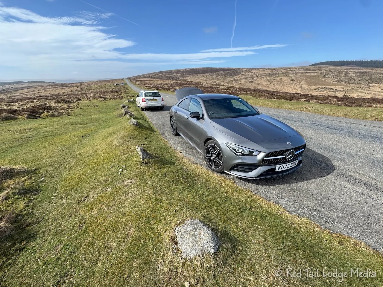
A little after 10 am, we checked out of the hotel in Exeter and hiked over to the Enterprise rental office with our luggage. This was going to be our first time driving on the left side of the road, in a vehicle with the steering wheel on the right side. The Enterprise staff walked us around the vehicle explaining everything. Then it was time to start driving.

Ann went first. It was about a 30 minute drive to our next destination, the Dartmoor National Park Haytor Visitor Center. We started out on city streets, going through several roundabouts. Ann did fine through the first few, then she got confused by the one where she had to go three quarters of the way around. She started off in the right of the two lanes but waited too long to get in the left lane to get off. So she continued around the circle and back to the previous roundabout and made a second go of it. The second time was still a little rough, but she made the turn.

Ann got a taste of all of the driving experiences, city streets, roundabouts, zebra crossings (crosswalks), avoiding cyclists, dual carriageways (divided highways), motorways (expressways), and narrow country roads. The narrow country roads were only one lane for two way traffic. In places, the road was barely wide enough for the width of our car. Ann didn’t have a good feel yet for where the edges of the car were, so it was a little nerve-wracking. When we reached the parking lot for the visitor center, Ann was more than ready to stop driving.

We went inside the visitor center to pay for parking there (3.20 pounds) and to get advice from the staff. The man at the counter was telling another couple some colorful stories about some visitors he has experienced. He was very helpful in giving us ideas and where to spend our time in the park. He also outlined a walk right from the visitor center which was a little shorter than the one Ann had downloaded in AllTrails. It was after 1 pm by this point, so we followed the route he described.

From the visitor center, we walked up to the Haytor. Dartmoor National Park is dotted with rock outcroppings called tors and Haytor is the most popular one. When we reached the tor, the cold wind was so strong it almost blew us over. So we didn’t climb to the top of the rocks as we didn’t want to get blown off them. Thankfully, we had our puffy coats and gloves on to keep us warm.

From there we made our way over to the Haytor Quarry. The quarry is the largest of five granite quarries in the area that operated from the late 18th century until the 1860’s. A small lake sits in the bottom of the quarry, with granite walls rising up around it, protecting us from the cold wind. It was pretty, but it’s probably even prettier in the summer when the lily pads are in bloom.

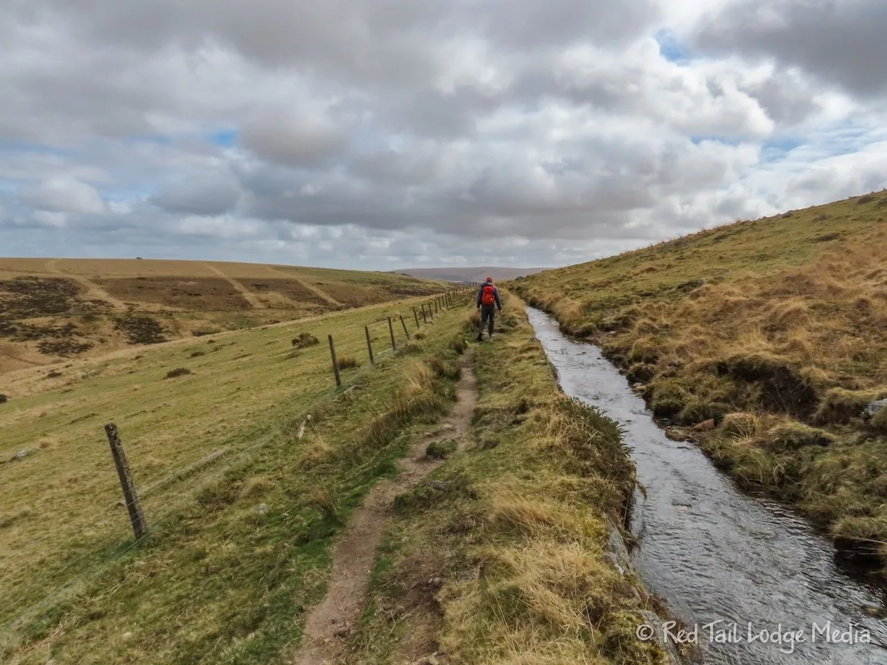
Coming out a gate on the other side of the quarry, we crossed an open moor to reach the tramway. What is left of the tramway are pieces of the granite rails or setts. The granite setts were used instead of iron rails. They were designed to take horse-drawn trucks to transport the granite from the quarries down to Stover Canal. Each truck could carry up to three tons of granite.

We followed the granite tramway all the way down to the road. Along the way, we passed by a herd of wild ponies. Dartmoor is know for all of its wild ponies. They looked like they had thick coats of hair, all the way down to their hooves, to protect them against the cold winds. At one point, we stopped to let one pony make his way across the tramway. Calling them ponies made them sound cute and harmless, but they are still large animals and we didn’t want one charging us.

By the time we reached the visitor center again, we had gone 2.6 miles with an elevation gain of 558 feet in an hour and a half. It was our third hike of our 52 Hike Challenge for 2025.

After we returned to our car, it was Keith’s turn to drive. From Haytor, Keith drove over to Widecombe-in-the-Moor to check out the village. The road to get there was a narrow country road, so Keith had to learn quickly where the four corners of the car were. As we approached the village, we pulled into a parking area alongside the road and walked into the village. It was a cute, little town, but it didn’t take us long to explore it.

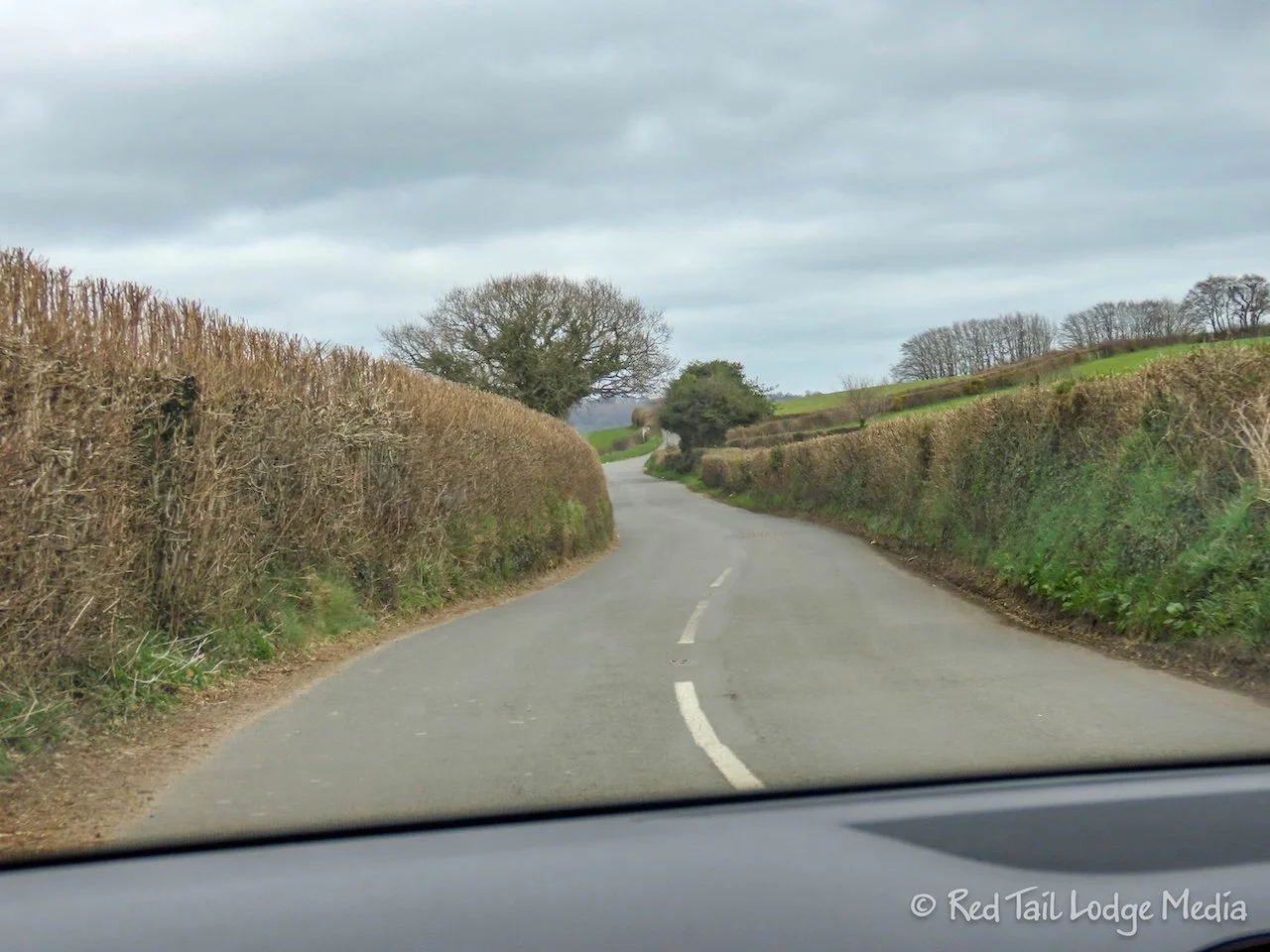
Getting back into the car, we put in Chagford as our destination, where our hotel was for the next three nights. We couldn’t figure out how to get our phones hooked up to Apple Play to use Google Maps for navigation, so we relied on the vehicle navigation system. From Widecombe, the directions took us on some really minor country roads. They were so narrow that not only did it stress Keith who was driving, but it also stressed out Ann as the passenger. We were sure we were going to scrape against a hedgerow, a stone wall, or slip a tire into the little drop-offs along the edge of the pavement. Then there was the stress of meeting a vehicle going the opposite direction, since these roads are all two way traffic. Luckily, we only met vehicles when there was room to pass (slowly) and we didn’t have to back up for anyone. Somehow we made it to Chagford with no damage to the car.

We found the town’s car park and figured out how to pay for parking by downloading yet another phone app. The car park only charges during the day, between the hours of 10 am and 6 pm. So we only had to pay for a couple hours, as we planned on being gone most of the next day. For two hours, it was only 1.20 pounds.

Our hotel was the Globe Inn, another charming place, just across the street from the church. We were in the Azalea Room, with a view out our window of the church. As we were checking in, we reserved a table for 7 pm for dinner in their restaurant. We hung out in our room until dinner.

The restaurant was busy that night. The staff warned us that they would be mobbed from 8:30 pm to 8:45 pm. There was a Shakespeare play being performed in the church, with a 15 minute intermission. People pre-ordered drinks for the intermission. The staff had everyone’s drinks lined up on tables for them to grab when they came. Just like clockwork, people filed in at 8:30. At 8:45, the staff rang a bell and everyone left to go back to the play. It was very entertaining to watch.

For dinner, Keith ordered the lamb shoulder while Ann had one of the specials for that night, the Moroccan lamb burger. To drink, Keith had the Jail Ale from the Dartmoor Brewery while Ann just had water. The food was delicious, our favorite meal in England so far.

Saturday, we had breakfast at the hotel, since it was included with our room. It started at 8:30 am. When we came down, there were signs on each table welcoming each room to their assigned table. Since the rooms had names instead of numbers, it seemed nicely personalized. There was a small buffet table with cold items, such as juice, yogurt, cereal, and fruit. Then you could order hot items off the menu, such as a full English breakfast, a breakfast sandwich, or porridge (oats). Keith chose the sandwich with bacon and egg while Ann had the porridge with honey and mixed seeds. While we enjoyed our breakfast, we had a lovely conversation with the English couple sitting at the table next to ours.

Our plan for the day was to hike the Wistman’s Wood Circular (loop). Ann started the day driving. We didn’t blindly follow the navigation this time. Instead, we looked at the map, trying to stay on the more major roads, even though they were still country roads. However, to reach those roads, we had to drive about a mile and a half on a smaller road to get to the A382. For some reason, there was a lot of traffic on that road that morning. It was a rather stressful stretch of road. It was also slow going, since Ann had to stop often to let traffic pass going the other way. At one point, she met a small truck with a line of cars behind it while there was also a line of cars behind her. We could not fit around each other. Ann had to back up about a quarter of a mile until there was room to pass. Then the truck squeezed by. As she watched the truck in her mirrors, she was sure it was going to scrape its side mirror on the car behind her. There must have been less than an inch between the two, but somehow everyone escaped without a scratch.

We drove all the way to Two Bridges on B3212 and parked at the trailhead for Wistman’s Wood. Being a Saturday, the parking area was pretty full, but we found a spot. We were expecting to have to pay for parking, but we didn’t see any signs or pay stations, so we assumed we were OK.

The hike was wonderful. The path went through a sheep farm and over some stone walls before reaching the woods. The small woods were oak trees, hundreds of years old, dripping with moss, with moss-covered rocks at their feet. Wistman’s Wood is one of Britain’s last remaining ancient temperate rainforests.

To protect the ancient wood, you are not allowed to enter the woods, but the trail skirts around it. The wood is not very big, so you get a decent view from the edge. We continued to follow the circular route from AllTrails past the wood.

After tromping through a boggy area, getting our feet wet, we came up to the weir (small dam) where we crossed the West Dart River. The weir controls the water flow to the start of the Devonport Leat (canal). The Devonport Leat diverts drinking water 27 miles to the dockyards at Plymouth Dock (now called Devonport), built in the 1790’s.

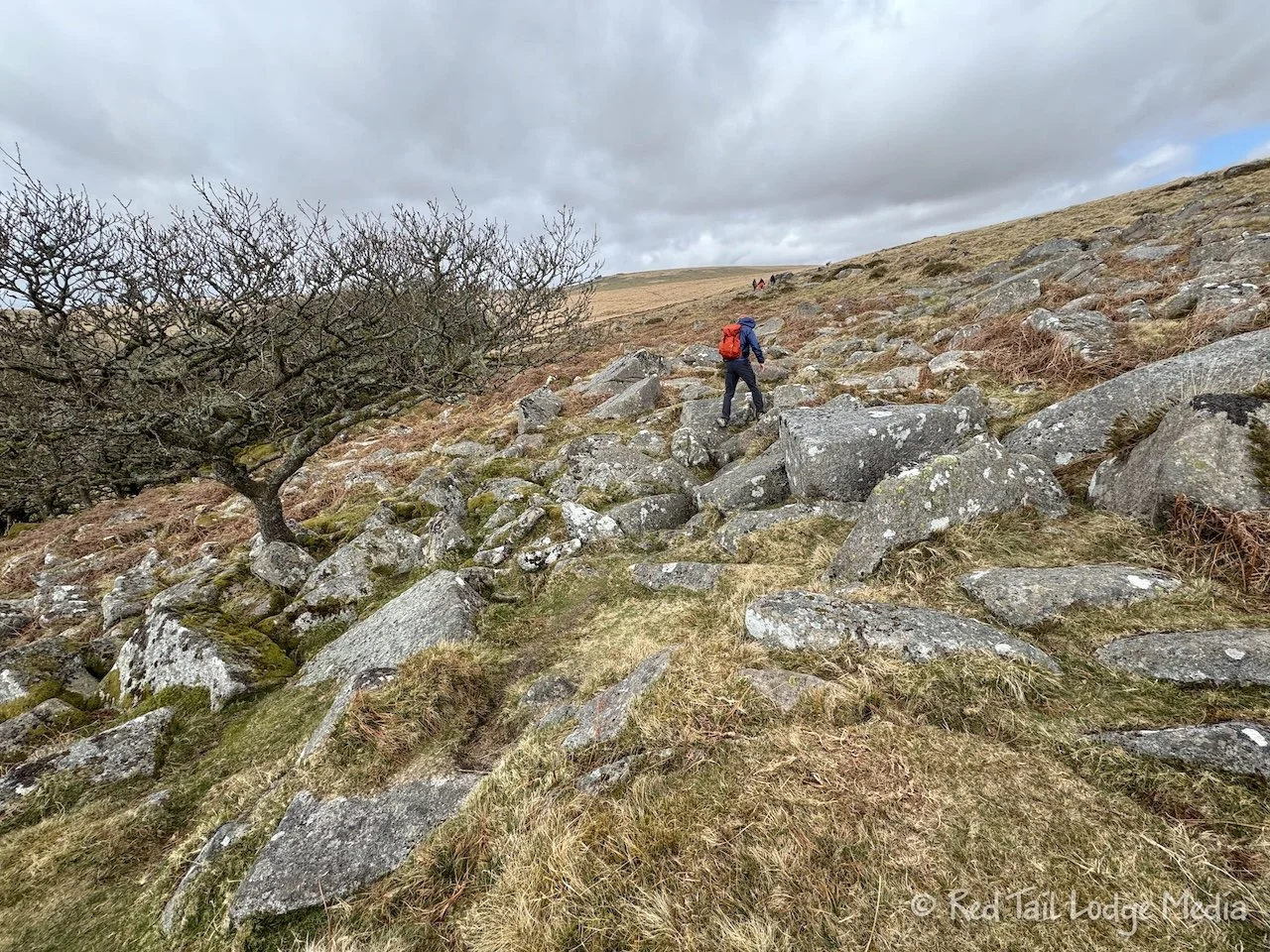
Before we crossed the weir, we stopped and chatted with a couple of backpackers. They recommended deviating from our route to climb up to the top of a nearby tor with a flagpole on top of it. The views of the surrounding area were worth the small climb. The flagpole is used to warn people when training exercises are in progress, so they will stay out of the firing range. A large area in the northwest corner of Dartmoor National Park is used for military exercises.
So that is what we did. After taking in the views, we were able to come back down and rejoin our original track. At this point, the route followed right alongside the Devonport Leat.

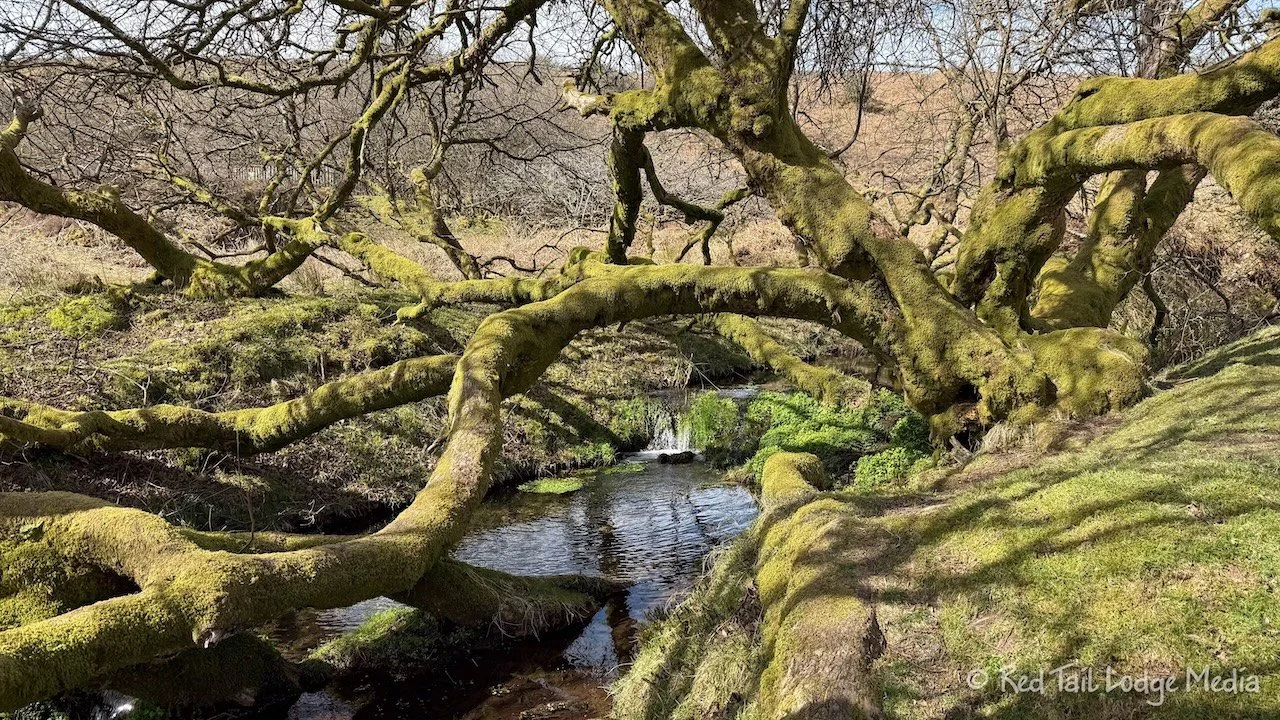
We passed by some sheep on the open moor, then we entered a pine forest. We enjoyed the pine forest as much as, if not more than, Wistman’s Wood. The granite walls of the leat were covered with moss, as well as the ground under the trees. It was a beautiful green oasis.
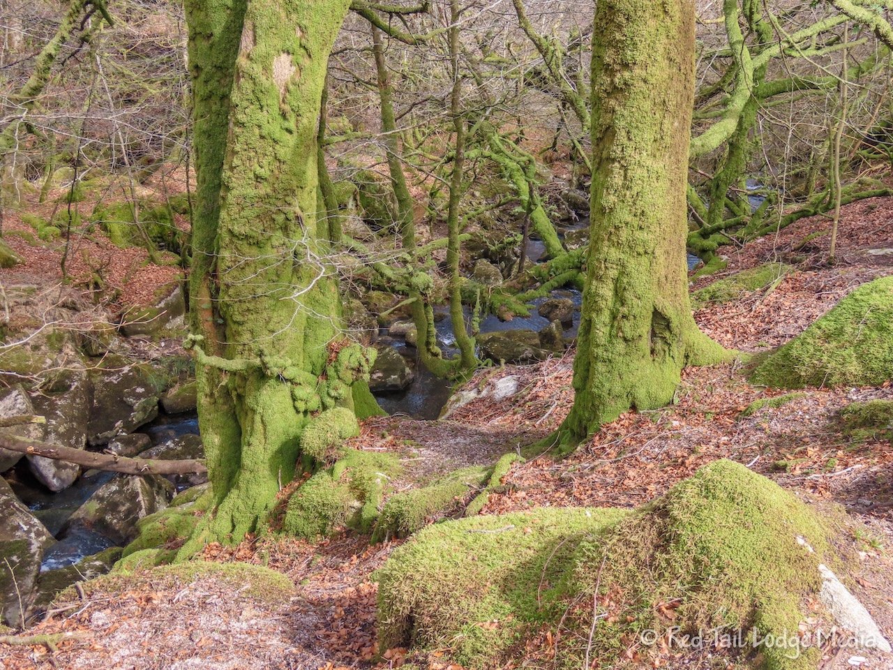
After emerging from the forest, we followed a gravel road through Beardown Farm before joining a foot path alongside a stream. Moss covered trees shaded the stream, with the sound of small waterfalls adding to the magical atmosphere. Soon we were on the road with a short walk along the shoulder to reach the parking area where our car was parked.
Our hike was 4.8 miles with an elevation gain of 787 feet which took us about three hours to complete. It was hike number 4 of our 52 Hike Challenge for 2025.

After changing out of our muddy shoes, we moved our car across the street to the parking lot of the Two Bridges Hotel, so someone else could have our parking spot to go on a hike. We went inside the hotel to use the bathrooms and have some tea.

It seemed like Cream Tea was the thing to order, so that’s what we did. We weren’t sure exactly what cream tea was, but we were about to find out. It is tea served with a scone, clotted cream or butter, and jam. Ours came with butter and Keith had coffee with his instead of tea. Ann noticed that they didn’t serve milk with the tea. Perhaps that varies by location, or they noticed we were Americans and probably didn’t want milk.

It was after 2 pm. As we sat in the lounge area enjoying our cream tea, the place started to fill up. About half the people were ordering cream tea and the other half were enjoying a pint of beer. So far, it seems like drinks, beer or soft drinks, came in two sizes, either a pint (568 ml, a little more than an American pint of 473 ml) or a half pint.

On the way back to Chagford, we stopped at the visitor center in Postbridge. Just like the other visitor center, there was a charge to park. We checked out the exhibits inside right before they closed. Then we walked down the street to check out the Clapper Bridge. A clapper bridge is an ancient form of bridge in England. The one in Postbridge is one of the best examples of one. The bridge was first mentioned in 1380, but it is thought to have been built as early as the 13th century.
Then Keith drove us back to Chagford. The road between Chagford and the A382 was not as busy on the way back, so Keith had no issues driving it. However, once he reached town, he did have to hop up over the curb onto the sidewalk a little bit to get around another car going the other way.

For dinner we decided to try a different place. We walked a block down the street to the Chagford Inn. It was about 6:45 pm and the restaurant was completely empty. That had us a little worried. But we stayed for dinner anyway. It was a good thing we did. The food was excellent. Apparently, most people in this area don’t go out for dinner until after 7 pm. By the time we left the Chagford Inn around 8 pm, the place was packed.

Keith ordered the venison burger while Ann had the Nduja sausage ragu with a side of roasted beets and hazelnuts. Nduja is an Italian spicy sausage and it was surprisingly very spicy, but also very tasty. Keith’s beer for the evening was the Golden Ale from Tavistock Brewery, located on the west side of Dartmoor National Park. For dessert, Ann had the chocolate delice (a French layered dessert) while Keith tried the panna cotta (an Italian molded cream thickened with gelatin) with a raspberry sauce. They were both delicious.

Sunday morning, we ate a light breakfast of yogurt, granola, and fruit. Ann drove the whole day so Keith could have the experience of driving back into Exeter the following day. But we didn’t drive as far on Sunday, which was OK with the both of us.
We were starting to get a little more comfortable driving on the left. What adds to the confusion is that, unlike the US, cars can park alongside the road in either direction, either with or against the flow of traffic, and you’ll usually see a mixture. When the center line disappears, then we knew that the road was probably too narrow for two cars to pass each other and we needed to pay even more attention to approaching vehicles.

The trail we hiked on Sunday was called Challacombe Down Circular in AllTrails. The trailhead was less than a 20 minute drive, about 7 miles, from our hotel. Thankfully, the traffic was light. The parking lot was full, but there was a pullout not far away that still had a spot. Ann parallel parked against the flow of traffic so she didn’t need to make a U-turn on the narrow road.

The hike went by all kinds of ruins and archeological sites, from a range of time periods in history. Near the trailhead was Bennett’s Cross. There are a series of stone crosses in Dartmoor National Park believed to be used for navigation across the moorland. Bennett’s Cross also marks the boundary between Chagford and North Bovey.
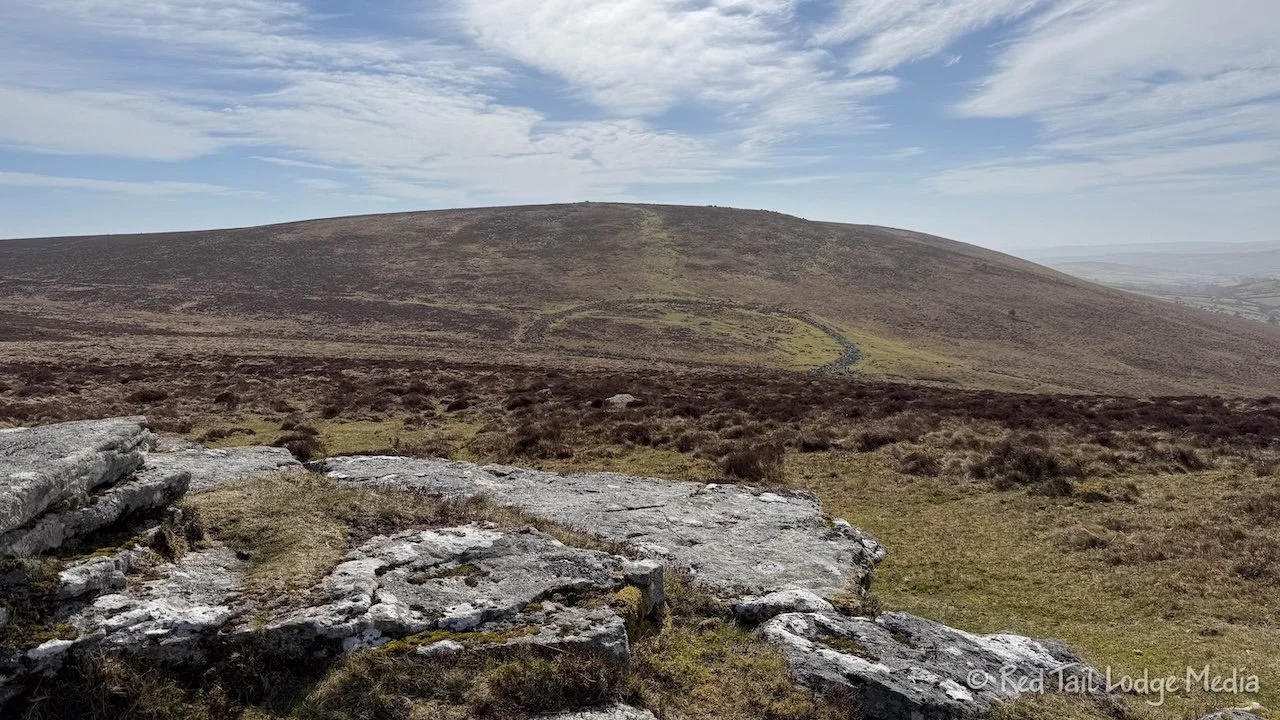
From the cross, we headed up to Hookney Tor with great views of the circle of stones that encloses Grimspound. Grimspound is an archeological site from the late Bronze Age (3300 BC to 1200 BC).

From the tor, we descended down to Grimspound, passing by some wild ponies. We walked inside the low stone wall to see a set of 24 hut circles.

Our route then took us through Headland Warren Farm. Headland Warren Farm, in addition to a lot of sheep, also had some alpacas.

It seemed rather strange to us to walk right through private property, but it was marked as a public bridlepath. It is our understanding that most European countries have what is sometimes called Right to Roam traditions or laws that allow people to pass through private property either on foot or on horseback, as long as they don’t camp on the land or damage any property.

As we rounded around the base of a hill, we entered Challacombe Farm. Challacombe Farm is still a working farm, but the land there has been farmed for thousands of years, since the Bronze Age. Near the present day farmhouse, there are the remains of seven medieval (5th to 15th century) houses.

The route back to Bennett’s Cross took us by the remnants of tin mining. The tin mining was from 1200 to 1930, taking alluvial tin from stream beds. The remains consist of mine pits, an engine house, a miner’s dry (shed for drying clothes), and Dinah’s House (a meeting place for miners).

We thought we were going to make it through our hike without getting our feet wet this time. However, several sections of trail near the tin mines were covered with running water from the streams. Fortunately, the trail was gravel and sand, so our feet didn’t sink down into the mud like the day before. So the water didn’t make it inside our boots. In fact, it washed off the mud from the day before.

By the time we returned to our car, we had gone 6.1 miles with an elevation gain of 961 feet in just a little over three hours. It was hike number 5 of our 52 Hike Challenge for 2025.

After changing out of our hiking boots, we drove the short distance over to Warren House Inn. It was a crowded place, but Ann managed to parallel park right across from the inn. She was a little stressed, as there was plenty of traffic on the road, lots of pedestrians, and parked cars lining both sides of the road blocking visibility. But she did it without damaging any vehicles nor harming any people.

The Warren House Inn is an historic inn, serving the tin miners back in the day. The current building is from 1845, but the original inn dates back to the middle of the 18th century. A warren is a network of interconnected burrows dug by rabbits, or it can be an artificial one built to raise rabbits. The Warren House Inn still serves rabbit pie today.

We were looking forward to trying the rabbit pie, but, unfortunately, they were understaffed that day and closed the kitchen early. We’re guessing the shortage might have had something to do with it being Mother’s Day. So we just had drinks, a cappuccino and a soft drink. From there, Ann drove us back to Chagford. Again, traffic was lighter than Saturday morning and she was very thankful.

For dinner, we ate at the restaurant in our hotel again. After breakfast that morning, we made a reservation for 6 pm. It was either that or much later, as they were booked pretty full. The Globe Inn has a different menu on Sundays. Keith ordered the roast lamb while Ann had the roast pork along with a caprese salad. The caprese had sausage and a mixed green salad with it. The sausage was similar to Ann’s ragu the night before, but not nearly as spicy.

Both our meals came with broccoli, carrots, roasted potatoes, stuffing, red cabbage, and Yorkshire pudding. We’ve never had Yorkshire pudding before. It is a type of bread (eggs, flour, milk, and meat drippings) that reminded Ann of a popover (which is made with butter instead of meat drippings). Yorkshire pudding is usually part of a Sunday roast, roasted meat (traditionally roast beef) accompanied by stuffing and gravy, served on Sundays. For his nightly beer, Keith tried the Dartmoor IPA.

We managed to save a little room for dessert. Ann had the chocolate torte while Keith had the lemon tart. Both came with clotted cream. Clotted cream is full cream cow’s milk thickened by heating it with steam, then allowing it to cool slowly. There was also something called profiteroles on the dessert menu, but we didn’t know what that was. Our waiter tried to explain it to us, but we opted not to try it. Researching it later, we discovered that profiteroles is the British term for cream puffs. We’ll have to look for those again. All the food was very filling and very delicious.

Monday morning, we had a leisurely breakfast at the Globe Inn in Chagford before driving back to Exeter to return the rental car. Ann had the full breakfast this time, a fried egg, mushrooms, tomato, baked beans, bacon, sausage, and hash browns. It did not include black pudding like the full breakfast we had in Exeter.
At breakfast, we chatted with a couple of German ladies from Hamburg. They visit Chagford every year to go letterboxing. Letterboxing is an old fashioned version of geo-caching. Letterboxing started in Dartmoor in 1854. Hikers on the moor would leave postcards or letters inside a box along the trail, addressed to themselves or a friend. The next person who found the box would take the postcard and mail it. Nowadays, the weatherproof boxes contain a notebook and a rubber stamp. People who find them stamp their personal notebooks with the stamp from the box and stamp the visitors notebook with their own stamp. Locations of letterboxes are listed in catalogs and on websites, or spread by word of mouth.

The proprietors of the Globe Inn, Graham and Mary, were gracious hosts and easy to chat with as well. But it was time to leave, so we checked out and drove back to Exeter.

Wild ponies, interesting landscapes, and historic sites made for a wonderful experience. Learning to drive narrow country lanes added excitement to the adventure. Throw in a charming B&B with delicious food to make the visit complete. What more could you want from a national park?
Check out our related video: Dartmoor National Park, England
(Ann)